
MINNEAPOLIS (WCCO) — Another January cold snap has arrived. And while it’s not the coldest we’ve experienced so far this month, it will linger a little longer.
WCCO Chief Meteorologist Chris Shaffer says the Twin Cities reached a high temperature of 42 degrees Monday, which is typical of mid-March.
No snow will fall overnight, but it will certainly get blown all around in northern Minnesota, which got some fresh snow Tuesday. Wind speeds will be as fast as 40 mph throughout the state, including the metro.

(credit: CBS)
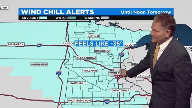
The National Weather Service has issued a widespread wind chill alert for Minnesota until noon Wednesday. This doesn’t include the metro and western Wisconsin. Most of the state will feel like the minus teens and 20s during this period, with parts of northern Minnesota feeling closer to minus 30.
Wind speeds will fall by Wednesday evening, but it will still feel below zero through Thursday – which will only have a high of 2 degrees in the metro.
We’ll warm back into the high teens Friday, which will also be our next chance for light snow. More flakes will possibly fly Saturday and Sunday, and temps will fall back to the single digits early next week.
Source: New feed
