
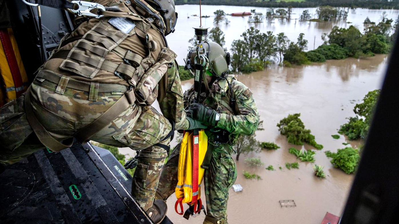
Residents in low-lying parts of Lismore have been told to evacuate their homes as flash flooding threatens the area.
The NSW State Emergency Service gave residents in North Lismore until 9pm on Monday, with those in South Lismore allowed another hour.
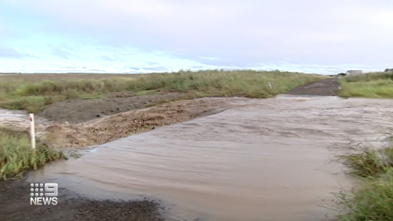
Rainfall continues to wreak havoc in the area, causing "life-threatening flash flooding" for a second time this month.
https://twitter.com/livgracecurran/status/1508364477632159745?ref_src=twsrc%5Etfw
Major flooding is possible for the Richmond, Wilsons, Orara and Bellinger rivers from Tuesday.
An evacuation centre has been set up at Southern Cross University, Military Road, Lismore.
Sandbags are available at the Woodburn SES unit.
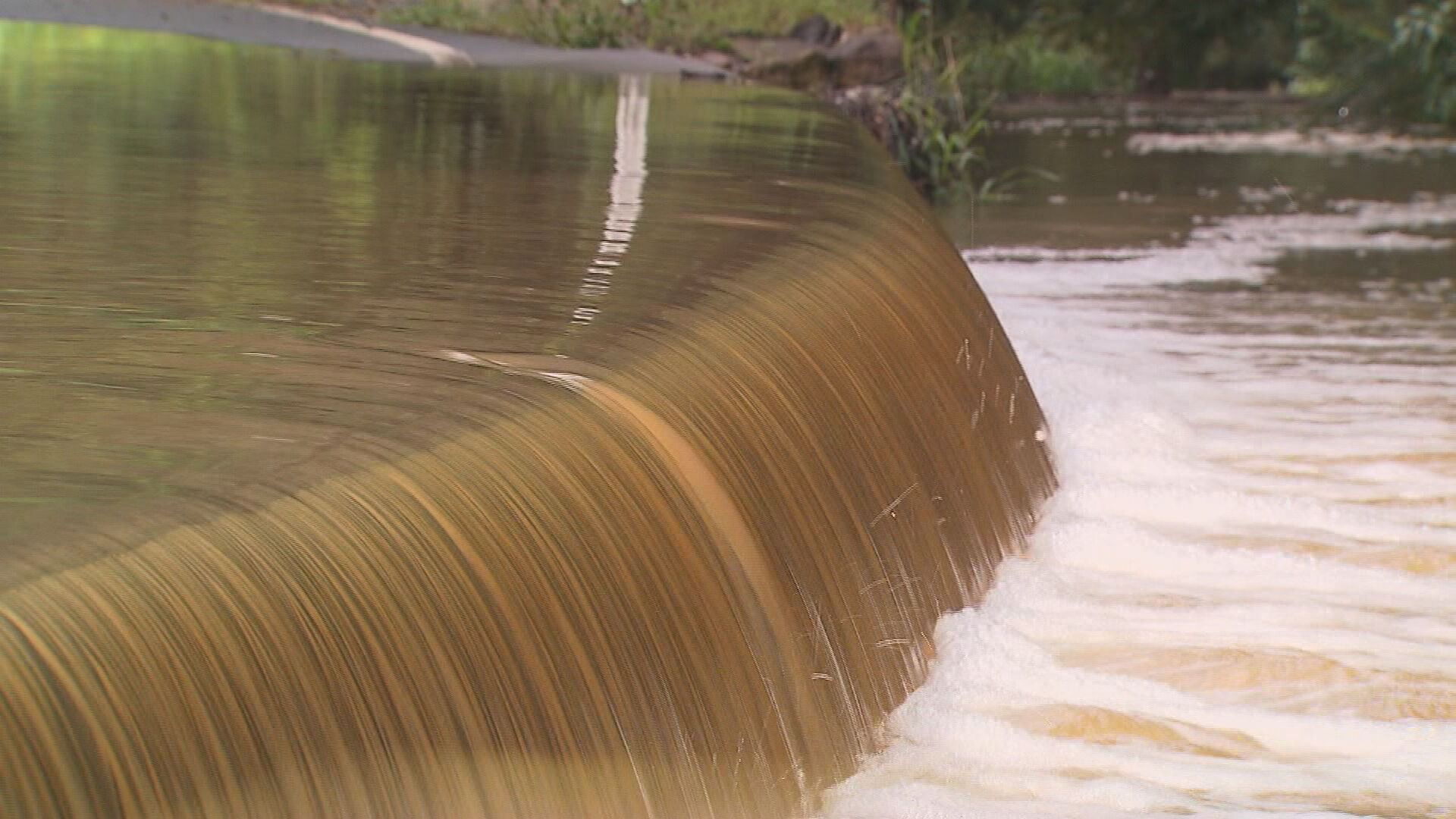
Moderate to major flooding could occur along Wilsons River at Lismore, and is predicted to exceed the minor flood level of 4.2m.
The river is expected to peak on Tuesday afternoon at about 10.5m to 10.6m.
South-east Queensland preparing for another soaking
South-east Queensland residents are also bracing for more wet weather and flash flooding ahead of an extreme weather event.
A major flood warning remains in place in the community of Dalby, west of Brisbane, as floodwaters spill from Myall Creek and the Condamine River.
The catchment was inundated overnight, triggering major flash flooding through the town.
READ MORE: Police search for driver of stolen car spotted driving dangerously in North Queensland
The Bureau of Meteorology expected flooding to peak about 12am on Tuesday at 3.65m, almost reaching 2011 flood heights.
Bureau emergency management meteorologist David Grant said while the rain event was unlikely to match the flooding seen last month, already-wet catchments meant flooding was still likely across the south-east.
"Given the wet catchments, we're going to potentially see very rapid rises in a lot of our creek systems across south-east Queensland in the next 24 hours," he said.
READ MORE: Kyiv staring down barrel of most brutal, medieval battle
QFES state commander of operations Cheryl-Lee Fitzgerald said emergency services had conducted nine rescues overnight and Monday with 80 calls for help.
One man has recently died in the floods after being discovered in his submerged ute while another man remains missing, bringing the state's six-week flooding death toll to 14.
"This is a reminder of how quickly, and dangerous these situations can get," Ms Fitzgerald said.
"We can not understate how dangerous this flash flooding can be.
"Expect it's going to be wet for much of the south-east region."
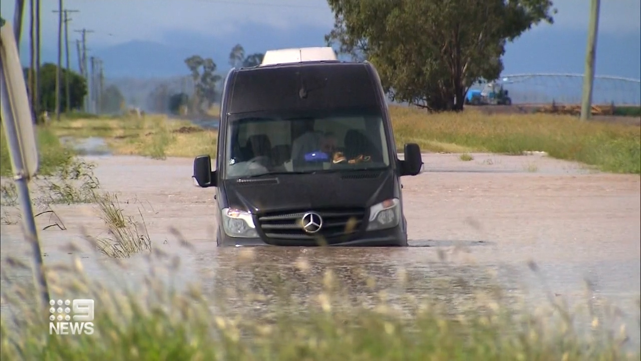
She said residents in the south-east should never drive through floodwaters and urged them to avoid driving at all where possible.
"We do ask the community please stay up to date with Bureau warnings over the next 24 hours," Ms Fitzgerald said.
READ MORE: What happened in aftermath of Smith, Rock confrontation
Several Dalby schools closed, residents warned to prepare

In Dalby, 11 schools have been closed due to the flood risk.
Residents have been urged to prepare should an evacuation be necessary.
Charlene Hall has secured furniture from low-lying levels of her home to the ceiling in preparation for more floods.
"Everyone knows we live on a flood plain," Ms Hall said.
"We've seen a bit of water come in through the town in the last few months, it's probably helped people be more prepared."
READ MORE: The number that puts Vladimir Putin at risk
https://twitter.com/BOM_Qld/status/1508287124642177036
Norm Townsend said after three floods in four months, fellow Dalby locals were now used to flooding.
"At home there I had 150mm I measured in my rain gauge," he said.
"I was half-prepared because we only flooded what, three or four weeks ago?
"This is the third time in four months I've flooded.
"Every time it gets higher, higher, higher."
Areas in the Condamine River catchment recorded 50mm-120 mm in the 24 hours to 9am today with Myall Creek receiving the most rain with 160mm.
Flood warnings have also been issued along the Bokhara River, the Condamine River towards Warwick, the Balonne River and Charleys Creek.
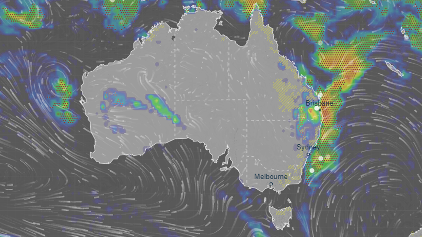
Queensland, NSW east coast in firing line for heavy rain and storms
A severe storm warning is in place for a 500km stretch of coastline across New South Wales and Queensland, as a rain bomb unleashes.
A month after the catastrophic flooding event, the said communities across north-eastern NSW and south-east Queensland were again at risk of "dangerous and life-threatening flash flooding".
Thunderstorms were also expected in Brisbane and the Gold Coast on Monday.
READ MORE: Ukrainian President demands more 'courage' from the West
Across the border in NSW, a minor to major flood warning is in place for the Culgoa, Birrie, Bokhara, and Narran Rivers.
Hazardous surf warnings have been issued for south of Cape Moreton, including the Gold Coast and in NSW's Byron Coast, Macquarie Coast and Hunter Coast.
https://twitter.com/livgracecurran/status/1508301382125703170
Main Beach on Stradbroke Island was closed on Monday due to dangerous surf.
The warnings came after the bureau put a stretch of coastline from Noosa, down to Coffs Harbor in NSW on alert.
Today, the bureau warned Queensland could see "locally intense rainfall leading to dangerous and life-threatening flash flooding possible with thunderstorms with six-hourly rainfall totals in excess of 200mm."
READ MORE: Second 'black box' found in China Eastern plane crash
https://twitter.com/BOM_Qld/status/1508334396901888000
A severe weather warning was also issued for people in Northern Rivers and parts of Mid North Coast and Northern Tablelands forecast districts of NSW, with up to 180mm of rain forecast.
https://twitter.com/BOM_NSW/status/1508189479303065609
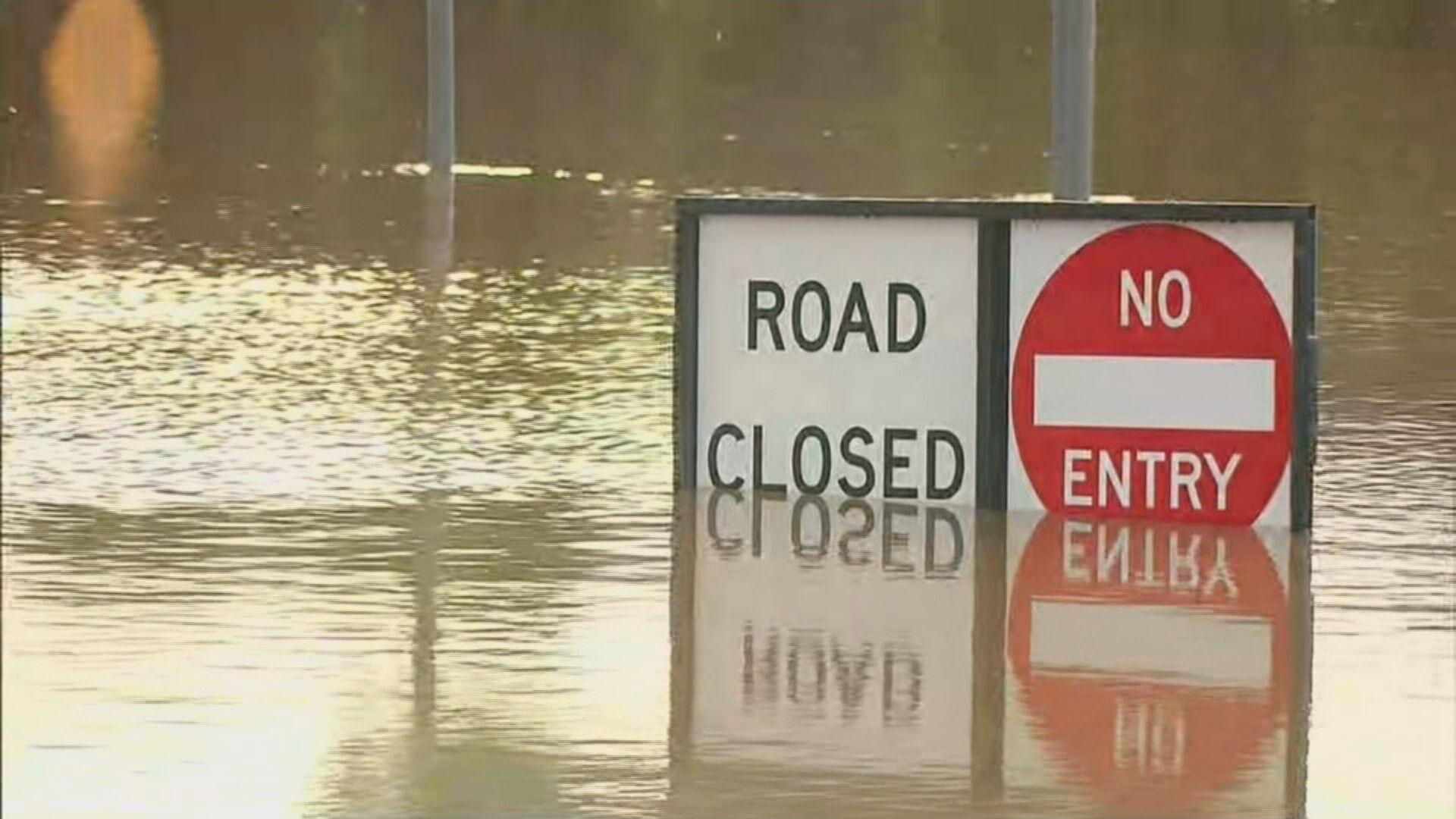
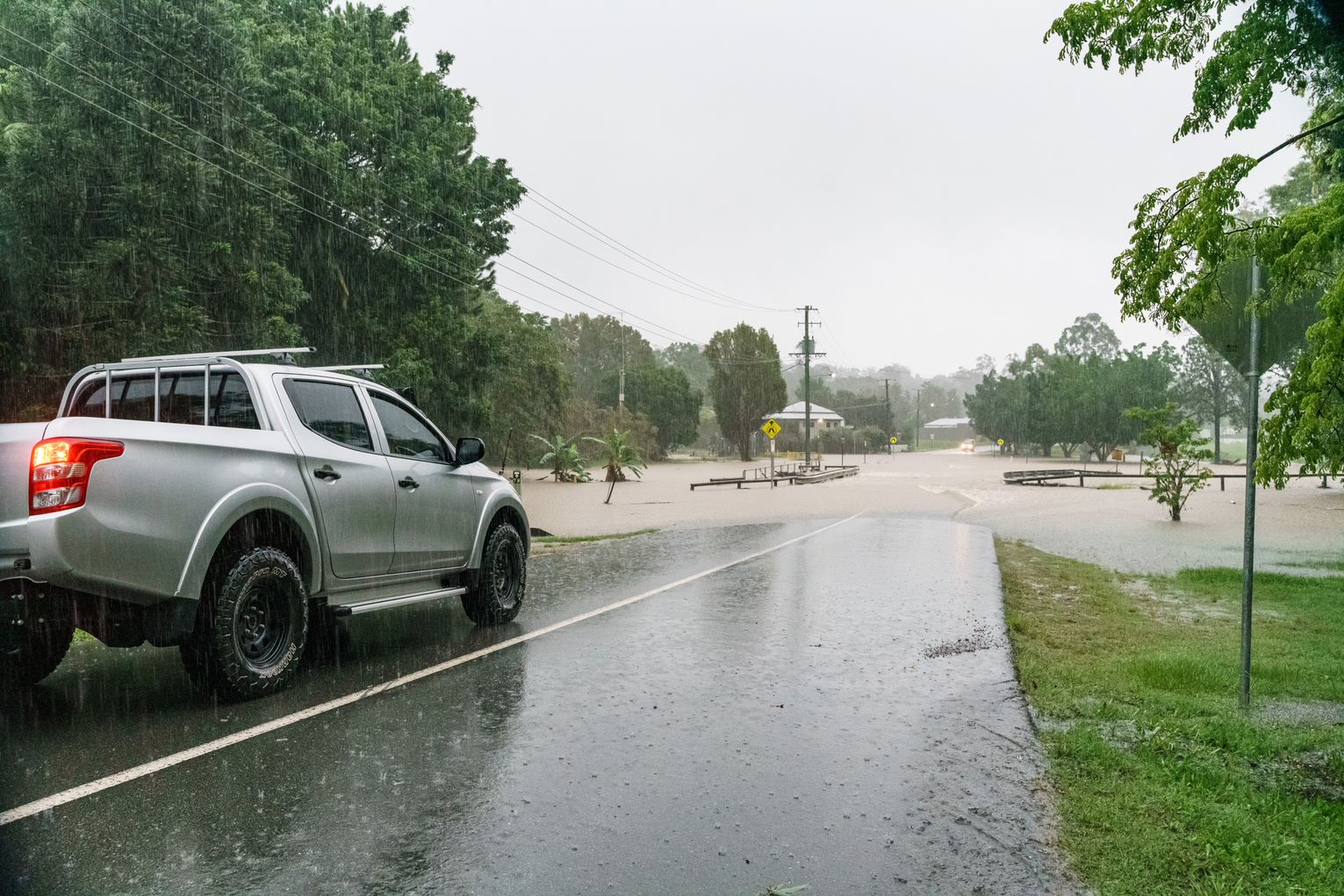
The NSW SES urged residents to take care, explaining the sodden ground and catchments heightened the risk of flash and riverine flooding.
"Our catchments are very wet, and our dams are full, so it will not take a lot for floods to occur," NSW SES Assistant Commissioner Nicole Hogan said.
"People need to monitor the weather conditions closely and be prepared to act early.
"In the event flooding does occur, there is a very real chance that roads can be impacted.
"If you are on the road and come across floodwater, do not attempt to drive, walk or ride through it. Instead, turn around and find another way."
READ MORE: Shanghai to lock down millions of people as COVID-19 cases explode
What is causing the rain?
Bureau meteorologist Jackson Browne said falls of up to 200mm had already been recorded across the Northern Rivers in NSW after a wet weekend.
He explained the wet weather was being caused by a coastal trough, deepening over south-east Queensland on Monday.
"A band of cloud and extensive moisture wraps around an upper level low," he said.
"That is creating severe storms.
"This upper-level low will cause a rapid deepening of the coastal trough."
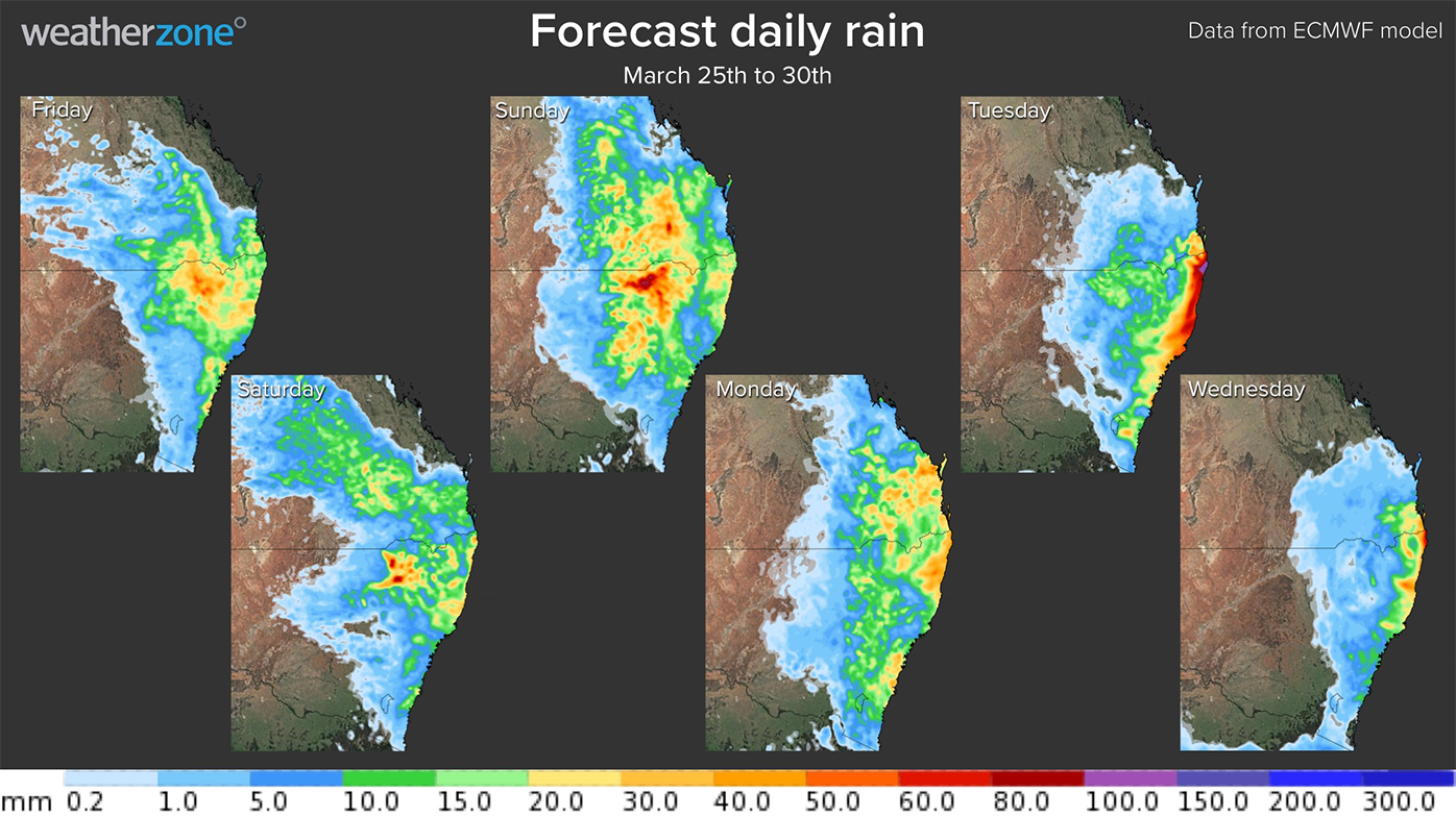
Rain activity is forecast to shift over the Northern Rivers "and possibly down to the Hunter region" tomorrow.
The weather bureau said the low pressure system was fast-moving, unlike the one that lingered for days at the end of February, responsible for the deadly flooding event across the two states.
"It does draw away on Wednesday," Mr Browne said.
"We should see a cessation mostly of the rainfall occurring through Queensland however the onshore flow will still create some showers and storms possibly for parts of NSW."
Source: 9News
