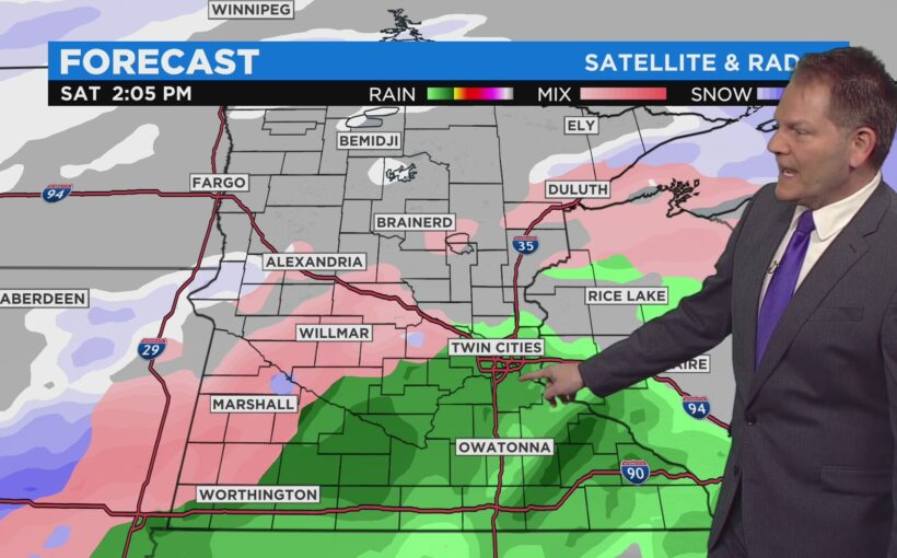
MINNEAPOLIS (WCCO) — New model runs suggest the multi-day storm system tracking toward Minnesota this weekend could bring significant rain to the Twin Cities, and even severe weather to southern Minnesota.
WCCO Chief Meteorologist Chris Shaffer says the storm system is still on track to hit Minnesota late Friday night and last through Sunday morning.
While the system is still a long way off, current models suggest it arrives initially as a wintry mix in southern Minnesota. However, on Saturday, following a surge of moisture from the Great Plains, heavy rain could fall south of the Interstate 94 corridor, including the Twin Cities.
According to Shaffer, counties along the southern Minnesota border could perhaps experience severe thunderstorms.
Models show the back end of the system bringing a blast of cold air and snow Sunday morning across much of Minnesota. It’s too soon to tell how much snow could stack up, especially given the precipitation will vary depending on local temperatures throughout the weekend.
Ahead of the weekend storm two other snow systems will hit Minnesota.
The first, an Alberta clipper system, arrived overnight Tuesday and was cutting across northern and central Minnesota on Wednesday morning, hitting the Twin Cities. Only a dusting is expected on Minnesota roads, and most areas should see half an inch or less. The precipitation should be finished by late Wednesday morning.
The second snow systems looks to be in store for Thursday morning, mainly hitting southwestern Minnesota. Communities there will likely see only a dusting of snow during the morning commute.
Temperatures through the week will gradually cool, with Thursday being the coldest day with highs in the mid-20s. The weekend storm will bring warmer temperatures, with highs Saturday expected to be in the mid-30s.
Source: CBS


