
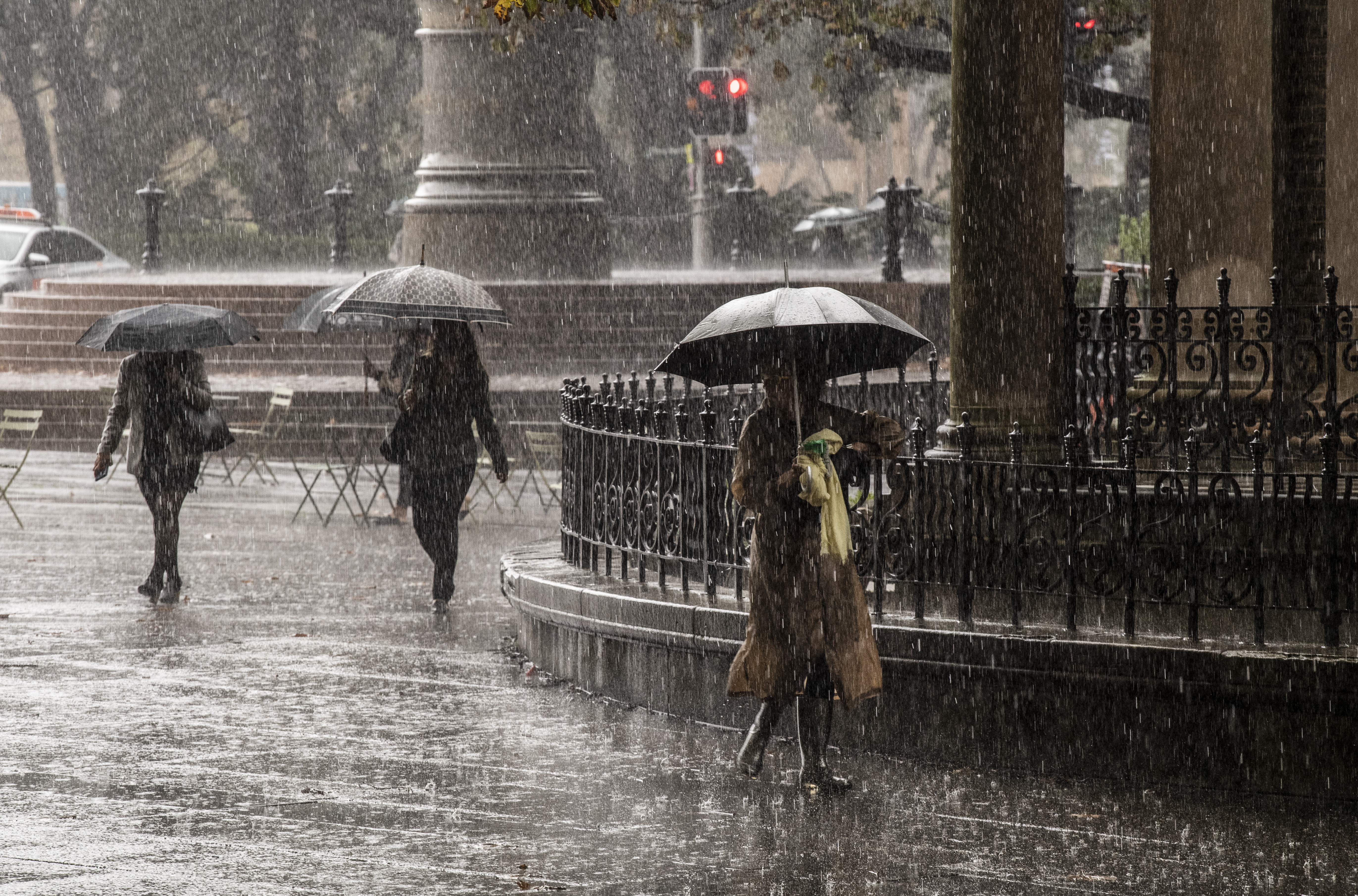
Sydney residents have been warned tomorrow's deluge could cause flash flooding as a month's worth of rain falls in just one day.
Meteorologist Jane Golding warned from the north at Port Stephens to the south at Bateman's Bay will experience heavy rainfall on Saturday with the weather event escalating until Tuesday.
"We're seeing the formation of a coastal trough off the NSW coast," she said.
READ MORE: 'Feel like I've died': Desperate pleas of women with long COVID

"We know these are quite dangerous systems and they've been known to create widespread flooding in the past and that's certainly on the cards for the next few days."
On Saturday, Sydney and the Illawarra will be in the firing line for the sudden downpour.
The Bureau of Meteorology warned flash flooding is likely over the next five days in Sydney suburbs.
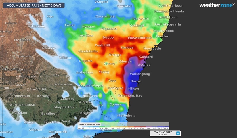
"With catchments already saturated and dams at or near capacity, there is a heightened risk of riverine and flash flooding as well as landslips along central parts of the NSW coast from Saturday," the bureau said in a statement.
"River levels are expected to rise from Saturday, with the largest impacts starting Monday or Tuesday next week.
"Wind and waves will also increase along parts of the coast from Saturday, with a risk of coastal erosion for some areas."
The Hawkesbury and Nepean, a region that has been devastated by flooding four times in the past two years, is now preparing for the possibility of yet another flooding event this weekend.
Flooding is also expected on the Cooks River, Georges River, Woronora, and Shoalhaven.
https://twitter.com/BOM_NSW/status/1542352595871842305
With the school holidays beginning today in the state, State Emergency Service (SES) Commissioner Carlene York warned families to be cautious when travelling to low-lying areas.
Heavy rain started to fall over Sydney last night and BoM has warned this is "increasing", with up to 20mm falling today.
The Warragamba Dam is currently 97 per cent full.
Weatherzone said within the deepening trough "several small-scale low pressure systems could develop" bringing powerful winds alongside heavy rain.
READ MORE: Tiny parasite threatening Australia's $70m bee industry
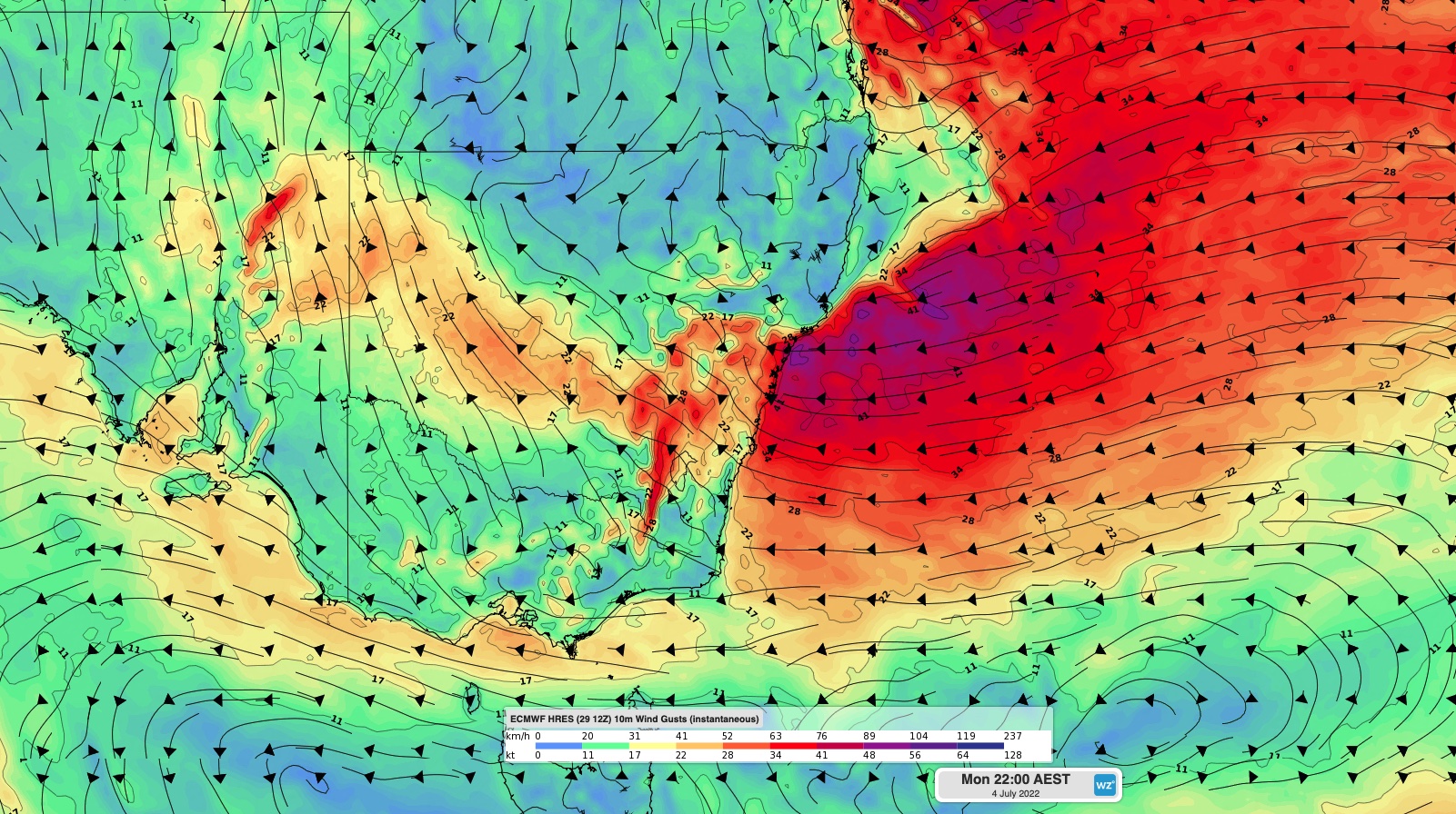
Weatherzone has urged residents across NSW and Queensland to stay on top of alerts amid the "dynamic" weather event.
"Accumulated totals in excess of 100mm are likely in some eastern districts of NSW and QLD from this weekend into early next week. Isolated multi-day totals of 200 to 300mm are possible, particularly near and to the south of any low pressure systems that develop close to the coast," it said, adding these totals will "shift a lot" over the coming days.
"Be sure to check the latest forecasts and warnings for the most up-to-date information."
READ MORE: Woman accused of killing elite cyclist captured
NSW warnings will be published here, while Queenslanders can keep across updates here.
Source: 9News
