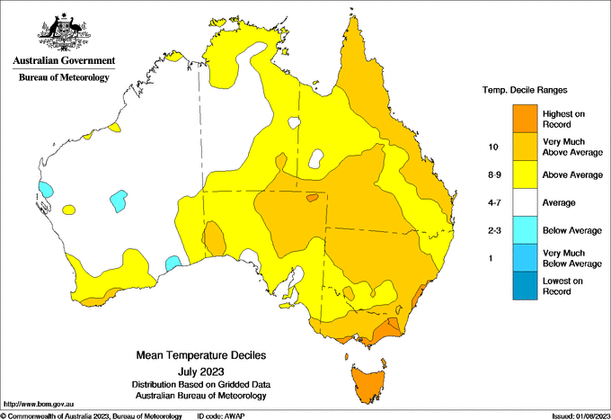
If you’ve been out and about the past few days, you may have noticed Australia is experiencing an unseasonably warm winter. It’s been t-shirt weather across many parts of the country’s east, including Sydney where temperatures topped 25 degrees on Sunday.
Meanwhile, at high altitudes, the cover at some snowfields remains lacklustre, even after warm conditions forced a delay to the start of the traditional ski season.
All this comes after the world experienced its hottest month since reliable records began. July brought an incredible 21 of the warmest 30 days ever recorded – prompting the United Nations to declare a new era of “global boiling”.
So what’s going on with the weather in Australia Should we just enjoy the pleasant conditions, or is it a troubling sign of what’s to come under climate change?
The nice weather, explained
Australia’s unseasonably warm conditions are the result of both natural drivers of our weather and continued global warming.
Since early July, warmer and drier conditions have dominated, due to a high pressure system sitting stubbornly over Australia at the moment. The clear conditions are leading to warmer daytime conditions.
For example, daytime temperatures in Canberra in July – historically known for its cold winters – were the warmest on record, despite frequent frosty mornings.
Sydney has just experienced its warmest July on record, too.
The high pressure has caused the air over the continent’s interior to warm. When cold fronts move across the south of Australia they push this warm air ahead of them, bringing warm and windy conditions to southern coastal areas.
This is similar to the weather pattern we see in summer when cities such as Adelaide and Melbourne experience their hottest days.
On Thursday, an approaching cold front is forecast to lift temperatures ahead of it to about 23 degrees in Adelaide, 20 degrees in Melbourne and 18 degrees in Hobart.
These are very warm temperatures in these locations for early August.
And what about the oceans? Around Australia, oceans are a bit cooler than average in some places including to the northwest of the continent.
But as the image below shows, ocean temperatures are currently above normal in many places around the world, including the west Indian Ocean and the central and eastern tropical Pacific. This indicates a developing El Niño and positive Indian Ocean Dipole – two natural climate drivers that affect Australia’s weather patterns.
This difference in ocean temperatures reduces the amount of atmospheric moisture over southern and eastern Australia. It also makes low pressure systems weaker and less frequent, reducing rainfall over the region.
Over the coming months, warm and dry weather is expected to continue. For the rest of winter and spring, it’s expected to be drier than normal in the southwest of Western Australia and much of the east of the continent.
And the whole of Australia is predicted to be warmer than normal during this period. Of course, this doesn’t rule out occasional cool, wet spells.
So is climate change a factor here?
Yes.
Australia’s land areas have already warmed by 1.4 degrees since pre-industrial times. This is the result of humans burning fossil fuels and releasing greenhouse gases.
The record winter warmth is part of a long-term upward trend in Australian winter temperatures.
As I’ve written previously, there has been at least a 60-fold increase in the likelihood of a very warm winter that can be attributed to human-caused climate change.
And we’re likely to see more record warm winters as the planet continues to warm.
Looking north
Of course, Australia’s spell of warm weather seems harmless compared to the Northern Hemisphere’s weird and wild summer.
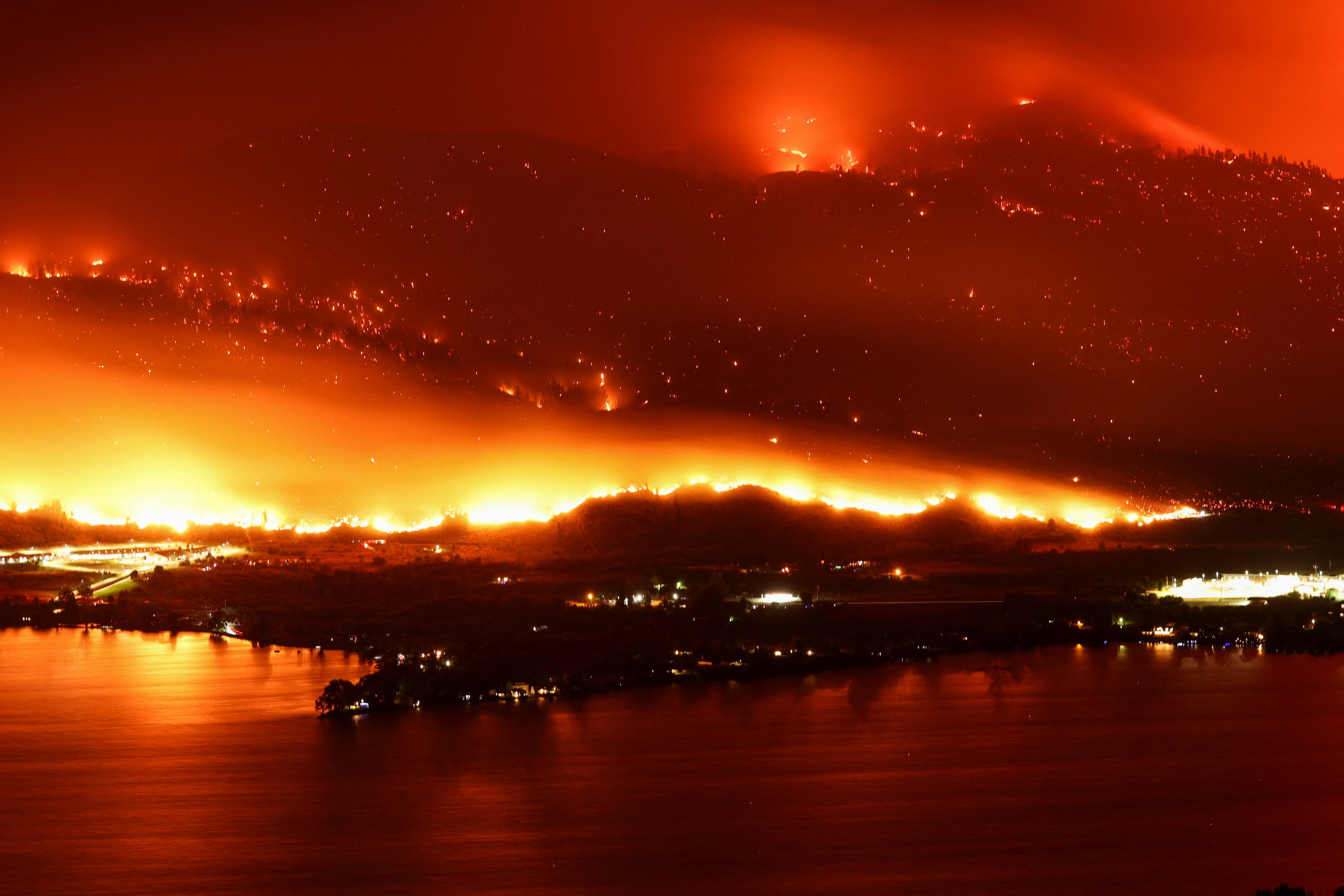
There, simultaneous extreme heatwaves have struck all four continents in recent weeks. Ocean temperatures are well above previous record highs for this time of year. Last week, 1,000 wildfires burned in Canada alone.
The planet’s warmest average temperatures typically happen in July. That’s because the Northern Hemisphere’s large land masses heat up more quickly than the oceans, in response to the high amounts of radiation from the sun. Still, the heat of the last few weeks has been unprecedented.
The heatwaves are linked to high-pressure weather systems that are “blocking” or deflecting oncoming low-pressure systems (and associated clouds and rain).
On top of this, human-caused global warming is greatly increasing the chance of record-breaking extreme heat events and concurrent heatwaves across many regions.
Worryingly, a rapid analysis by international experts suggests the extreme heat should not be viewed as unusual, given the effects of climate change. For example, it says China’s recent record-breaking heatwave should now be expected about once in every five years, on average.
Not all extreme weather events can be attributed to human-caused climate change. But the study found climate change significantly contributed to the recent heatwaves in China, North America and Europe.
A sign of what’s to come
The Northern Hemisphere’s heatwaves are very alarming. But Australia’s temperatures are also unusually high for winter – and this is also cause for concern.
Warm winters in Australia can negatively affect some parts of the economy, including the ski industry. It also disrupts flora and fauna and increases the chance of “flash droughts” – where drier-than-normal conditions turn into severe drought in the space of weeks.
The warm, dry conditions may also lead to an earlier start to the fire season in Australia’s southeast.
So while we may appreciate warm winter weather, we mustn’t forget what’s driving it – and how urgently we need to stabilise Earth’s climate by slashing greenhouse gas emissions.
This article was written by Andrew King, Senior Lecturer in Climate Science at The University of Melbourne, and is republished from The Conversation under a Creative Commons licence.


