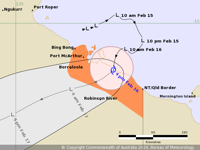
Tropical Cyclone Lincoln is crossing the coast as a category 1 storm between the Northern Territory-Queensland border and Port McArthur.
The weather system will continue to move inland and will likely weaken below tropical cyclone intensity during the evening, according to the Bureau of Meteorology.
The cyclone will then move west across the central Northern Territory over the weekend.
READ MORE: Sea off NSW is so warm it could support a tropical cyclone
Gales with damaging wind gusts up to 110km/h are expected to develop along the coast between Bing Bong and the Northern Territory-Queensland border during the evening.
Heavy rainfall is expected along the southern Gulf of Carpentaria coast with locally intense rainfall around the cyclone's centre.
Tides will be higher than normal across the southern Gulf of Carpentaria today and tomorrow, while large waves may produce minor flooding of low-lying coastal areas as the system nears the coast today.
READ MORE: Sydney driver's outrage over tiny detail in $129 parking fine
The Bureau of Meteorology has issued a range of flood watches and warnings along with a severe weather warning.
"After crossing the coast, the system will downgrade quite quickly to a tropical low, however the wind and heavy rainfall that is associated with this broad area of circulation, the risk of those hazards still continues," Bureau of Meteorology forecaster Shenagh Gamble said earlier.


