Fresh warnings have been issued for major flooding in Queensland and NSW, as heavy rainfall continues across large parts of Australia’s east coast.
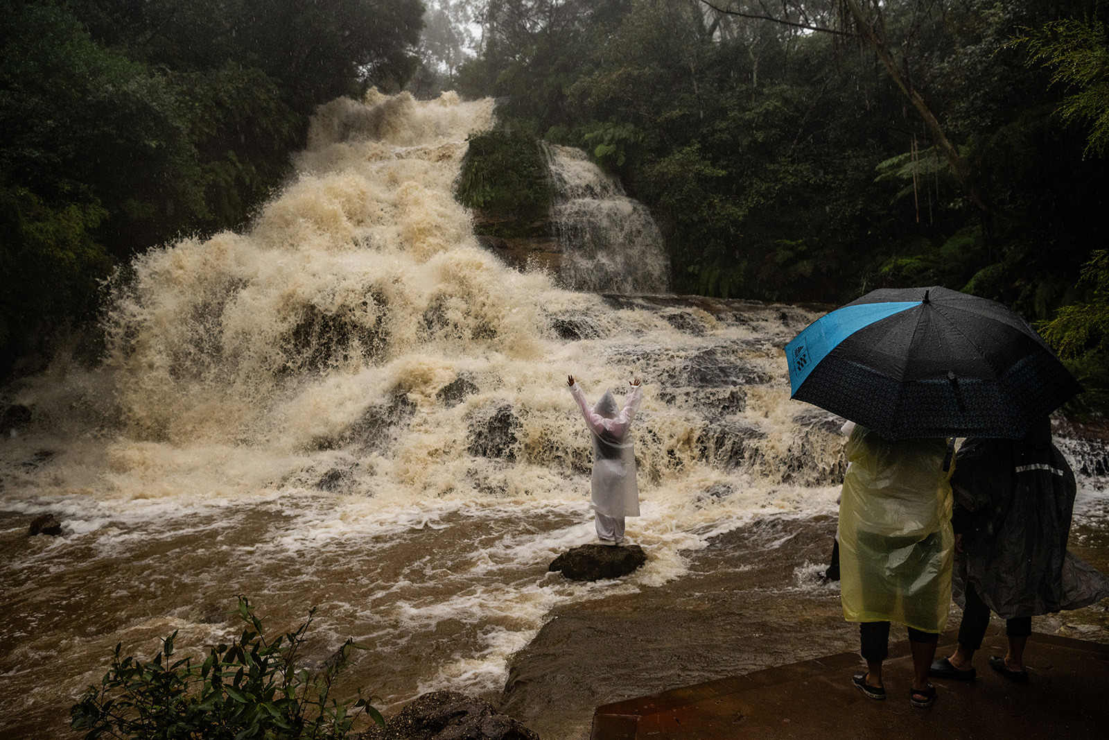
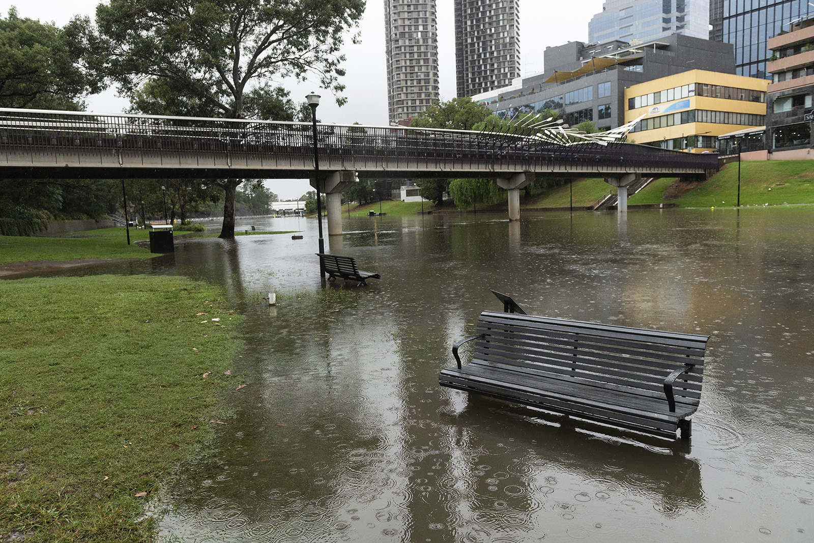
Sydney and much of Australia’s east coast were inundated with a month’s worth of rain on Friday, but residents in many of the impacted regions have been warned the worst of the deluge is yet to come.
More than 100 millimetres fell in many areas of Sydney in the 24 hours to Friday night alone, and rain was expected to intensify overnight and into this morning before easing later today and tomorrow.
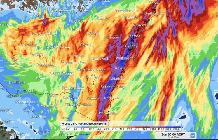
The Bureau of Meteorology (BoM) forecasted severe storms to impact much of NSW through the night.
Areas from Eden at the Victorian border and up into the Hunter Valley region were under warnings for widespread heavy to locally intense rainfall and damaging wind gusts.
“The heaviest rain is likely to occur around the Illawarra escarpment and maybe inland parts of the Greater Sydney region as well, where up to 300mm is possible through the course of this entire rainfall event,” meteorologist Angus Hines said earlier on Friday.
According Weatherzone’s models, in the six hours to 6am, parts of NSW, including Gosford, Sydney and Wollongong, could see totals of about 100mm.
Those heavier falls will then head south, impacting Bateman’s Bay and surrounding regions across the day.
Some residents in Chipping Norton, not far from Liverpool in Sydney’s west, were told to evacuate by midnight due to the risk of flooding at Georges River.
Evacuation centres were set up at Club Liverpool and Bankstown Sports Club.
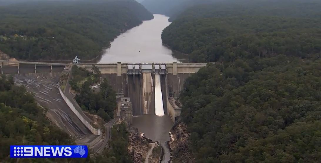
Adding to flood concerns for parts of western Sydney, the Warragamba Dam was at 96.3 per cent capacity, with potential to spill in the coming days.
Residents around the Hawkesbury area have sandbagged to prepare their properties.
NSW SES also opened an evacuation centre at Richmond Club.
As of 12.30am (AEDT), there were 78 warnings from the SES, ranging from Bega in the south-east all the way up to Lismore in the north-east and inland to Moree and Boggabilla in the north-west.
The SES said it had already responded to more than 820 calls for help due to the weather by midway through the afternoon.
Elsewhere in the city, travellers suffered significant disruptions due to the cancellation of more than 100 flights in and out of Sydney Airport.
While the city’s train network suffered major delays and cancellations after equipment was damaged at the key station of Redfern, just south of the CBD.
Transport for NSW was forced to move services to roughly every 10 minutes during the afternoon and evening peak, instead of the usual three to four minutes, due to the disruptions.
In addition to the rain, strong winds of up to 90km/h have been forecast by the weather bureau for much of NSW, which has also warned of the chance of “dangerous and life-threatening flash flooding” and damaging surf.
“The widespread severe weather risk is forecast to clear south of the Hunter and Sydney Metropolitan areas by sunrise on Saturday, the Illawarra by late Saturday morning and the South Coast by Saturday afternoon,” the BoM said.
“More isolated severe thunderstorms may redevelop on Saturday afternoon.”
In Queensland, multiple flood warnings were in place with heavy falls due to hit southern Brisbane, Logan and the Gold Coast. The worst of the forecast was for the Darling Downs.
The BoM said up to 100mm of rain could fall in a short period and, like south of the border, the threat of severe weather would increase on Saturday and Sunday.
The unstable weather situation along Australia’s east coast could even produce the weather phenomenon dubbed a “black nor-easter”, which is when storm clouds so dark and heavy effectively turn the skies black during the day.