

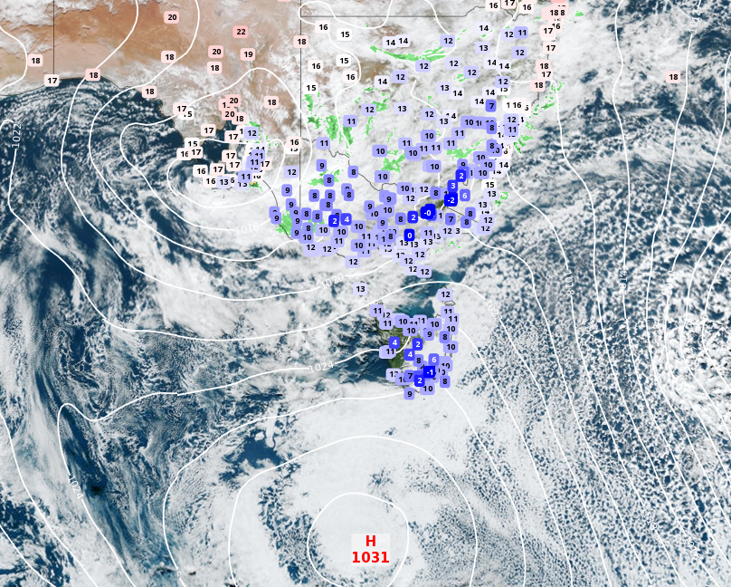
The Bureau of Meteorology says majority of Australia will be hit by a blast of wintry weather this weekend.
Temperatures in Melbourne struggled to reach a maximum of 13 degrees on Friday and are set to only improve by one or two degrees today and tomorrow.
This comes after the Victorian capital shivered through its coldest day in five years on Thursday as the mercury only reached 10.1 degrees.


The BoM predicts the cold weather will stick around much of Southern Australia, with light rain to persist along the NSW coast.
Temperatures plummeted to 0 degrees in the early hours yesterday and many parts will see maximums of under 10 degrees over the weekend.
Large parts of NSW are expecting showers and cold conditions.
Sydney can expect a maximum temperature of 16 today along with some rain, before a cold, cool day tomorrow.
Across inland parts of the state the mercury will struggle to reach 15 degrees.
Tasmanians will bear the brunt of the wintry blast, with Hobart reaching only 12 degrees over the next couple of days.
Several strong wind warnings were issued for the NSW coast, with hazardous surf warnings in place as well.
The cause of the cold snap over south-eastern regions is abundant cloud cover blocking the sun and trapping cold air near the surface.
July to September days and nights are very likely to be warmer than average across Australia, with an increased chance of unusually warm days and nights.
During that period, rainfall is likely to be above average for parts of the interior and eastern seaboard, and below average across much of Victoria and Tasmania, south-east South Australia, and parts of south-west Western Australia.
