

Ex-tropical cyclone Zelia has been downgraded to a tropical low but heavy rainfall and major flooding persist as the system continues to move south in Western Australia.
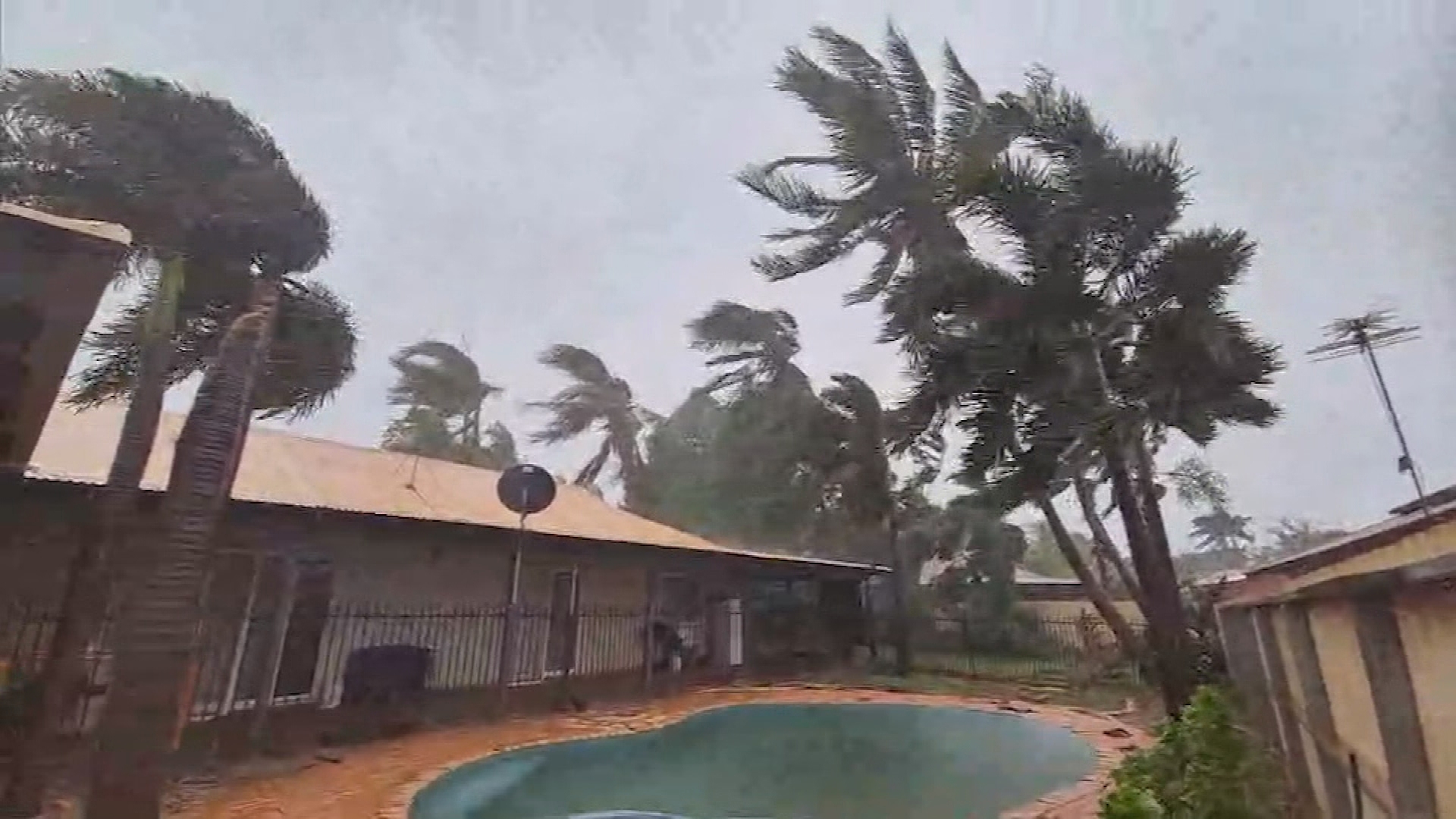
Zelia made landfall near the De Grey River, 54 kilometres north-east of where it was expected to hit Port Hedland, as a category 4 storm about 12.30pm (3.30pm AEDT) yesterday.
It brought intense rain and winds, which uprooted trees, flooded roads and damaged homes, before weakening overnight and into the early hours of this morning.
READ MORE: Police execute search warrant at one Sydney nurse's home
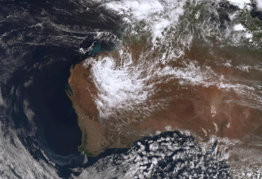

Today, the Bureau of Meteorology announced the system lost its status as a tropical cyclone and is now impacting the region as a tropical low.
The tropical low is currently located over the eastern Pilbara, southwest of Marble Bar, and is tracking south.
"It will leave the Pilbara and move into the far north-eastern Gascoyne. Still heavy rain anticipated as it is moving southwards," senior meteorologist Angus Hines said.
It is forecast to bring 24-hour rainfall totals of up to 100mm which could lead to flash flooding over the southeast Pilbara and northeast Gascoyne districts today.
The rain is set to ease by this evening.
READ MORE: Teen girl dragged in front of family, assaulted by group as old as 33
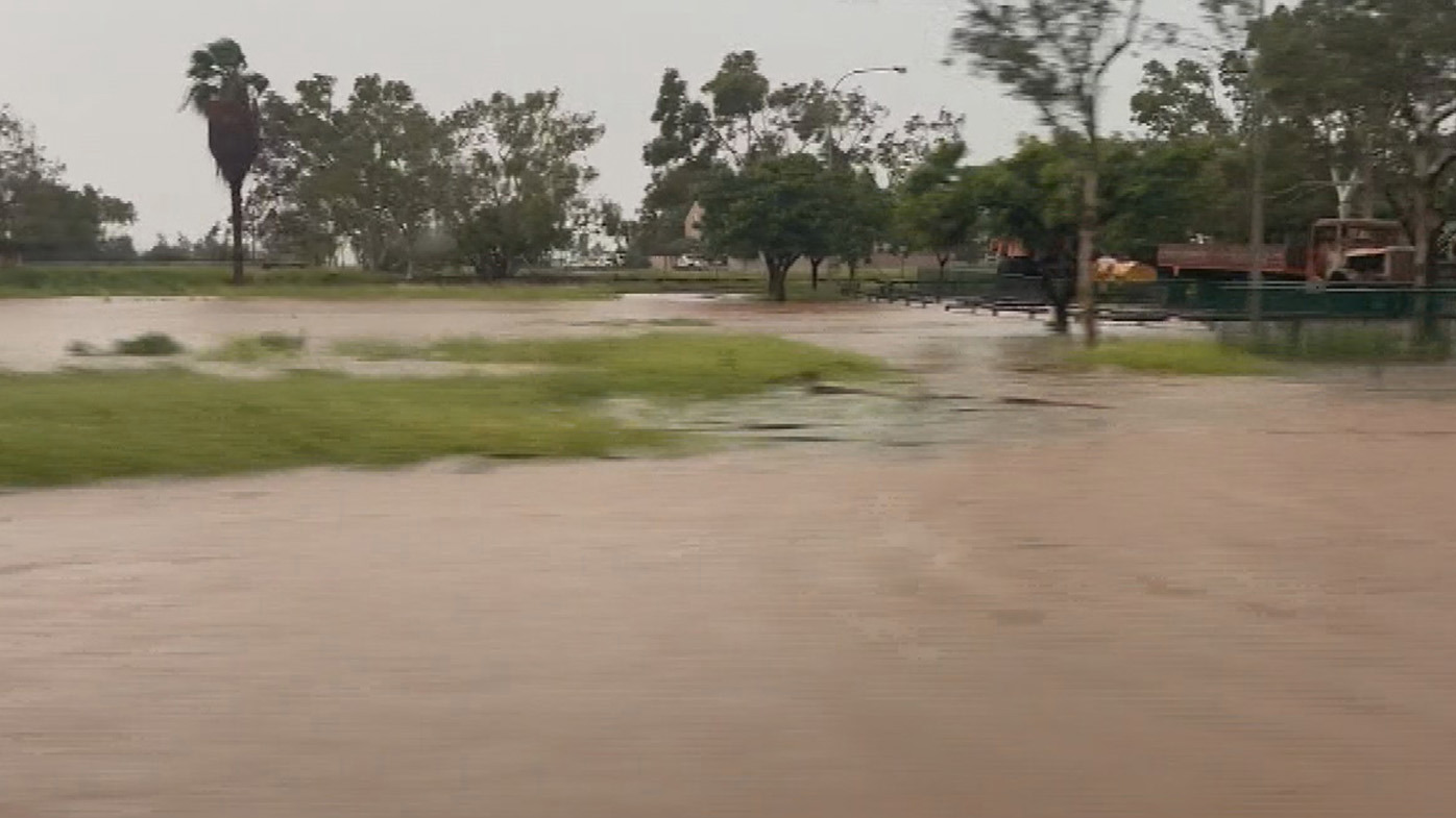
Major flooding is occurring in the De Grey River Catchment.
A flood warning has been issued for the Pilbara Coastal Rivers and an initial flood warning is in place for the Sandy Desert.
The Fortescue, Ashburton and Gascoyne Rivers are under a flood watch.
But, as the tropical low promises high rainfall totals, more rivers could see flooding.
"There is also a flood watch in place covering most of northern WA as we could see new rivers experiencing flooding conditions over the next day or two given the upcoming rainfall," Hines said.
https://twitter.com/BOM_au/status/1890555574854558200?ref_src=twsrc%5Etfw
The SES has already received 60 calls for help.
It is still too early to assess the extent of damage the ex-tropical cyclone has caused.
The region will see some relief by tomorrow, when the wet weather is forecast to become patchier.
"We'll start to see some gaps and some holes in the rainfall," Hines said.
"It will thin out and the rainfall totals will get lighter on Sunday as all of that moisture moves southward."
DOWNLOAD THE 9NEWS APP: Stay across all the latest in breaking news, sport, politics and the weather via our news app and get notifications sent straight to your smartphone. Available on the Apple App Store and Google Play
