

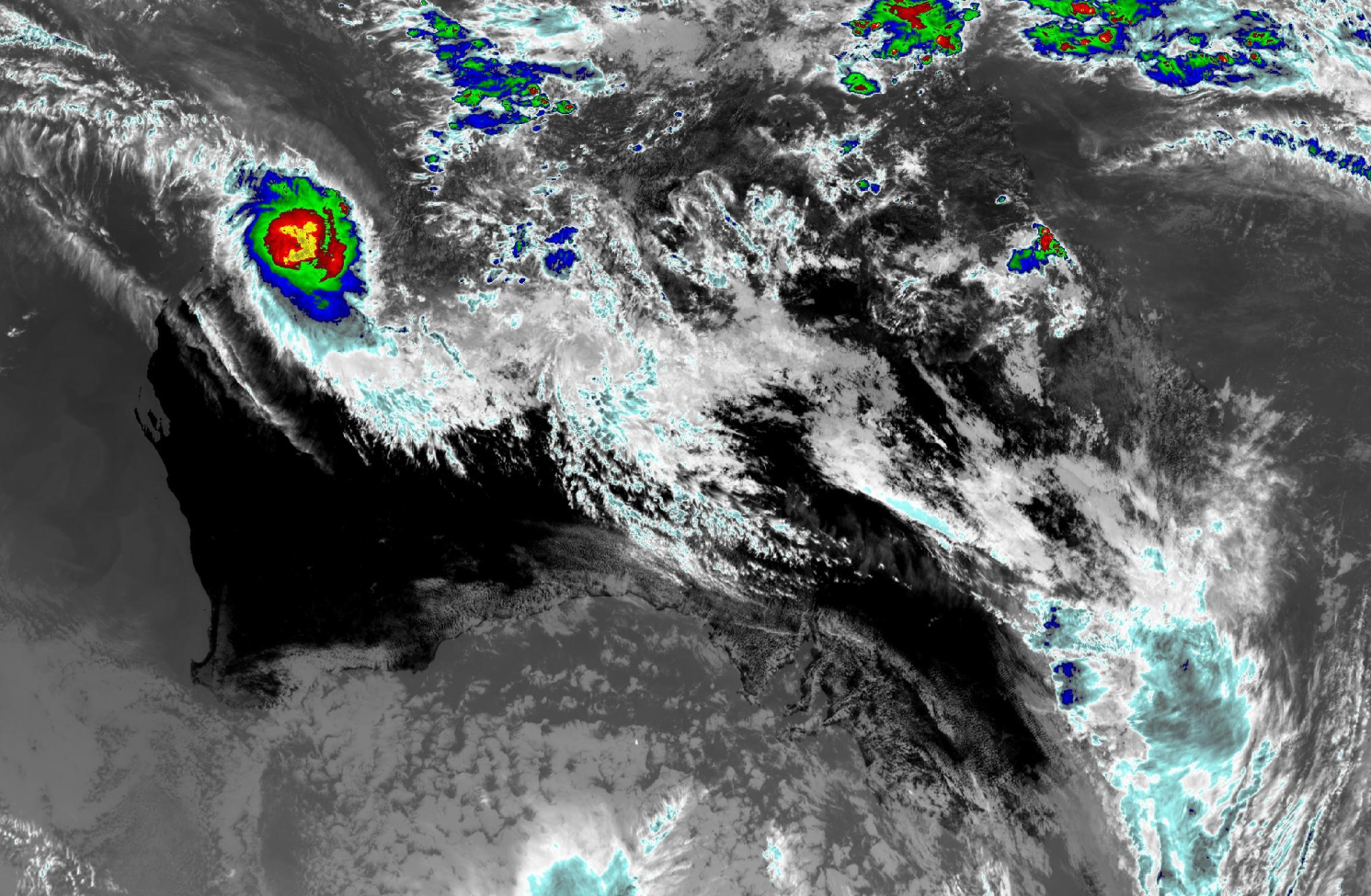
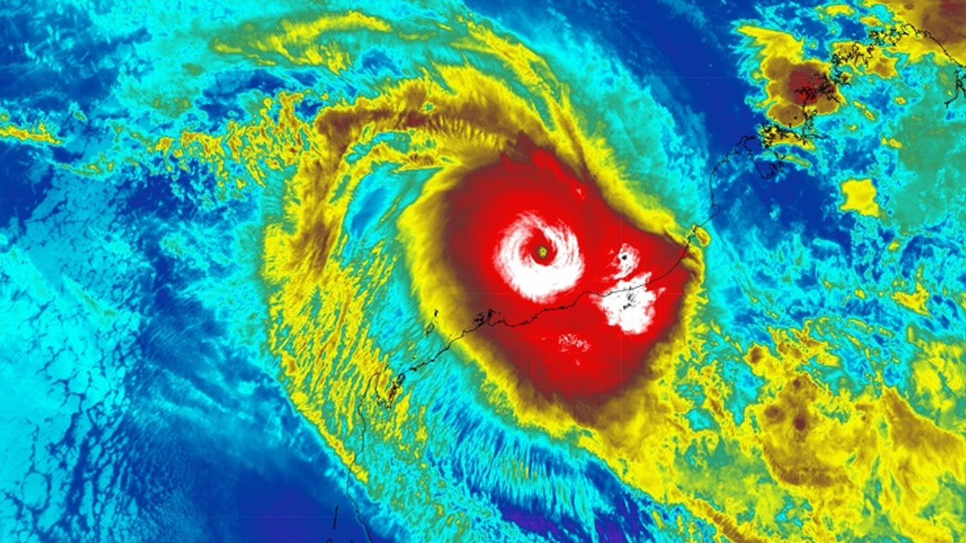
Tropical Cyclone Zelia has crossed Western Australia's coast with residents braced for 290km/h winds, more than 500mm of rain and flash flooding across the Pilbara region.
The weather system made landfall at 12.30pm (AWST) near De Grey River mouth northeast of Port Hedland and was downgraded to a category 4 storm by the Bureau of Meteorology.
The severe tropical cyclone will take a general southerly track overland and weaken.
WARNINGS: Check the latest evacuation warnings here and weather warnings here

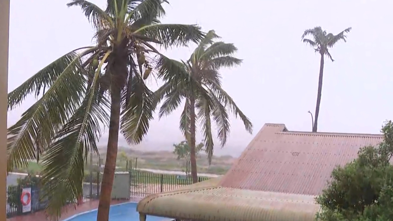
Residents in the area, which is one of the world's largest iron ore exporters, have been told to stay inside.
It is all hands on deck for emergency services in the area, who are getting ready to help in the aftermath of the cyclone.
Earlier today drivers were urged to stay off the roads with some spotted attempting to drive through dangerous floodwaters.
READ MORE: 'Full video' of Sydney nurses' antisemitic comments shared
"At midday Friday (AWST) the centre of the system was around 65 kilometres to the north-east of Port Hedland and moving south-east around 11km/h," Matthew Collopy from the Bureau of Meteorology said.
"The very destructive core of the system, the area around the eye of the cyclone, is impacting that coast to the east of Port Hedland now, bringing wind gusts of up to 290km/h and intense rainfall and flooding.
"Port Hedland is not expected to be impacted by the very destructive eyewall winds.
"But damaging to destructive wind gusts are still likely this afternoon and into this evening."
Collopy said on the eastern side of the tropical cyclone track, a dangerous storm surge is possible, which could cause flash flooding in coastal areas.
Rainfall totals between 200mm to 300mm are expected over the next 24 hours, with up to 500mm possible over the next three days.
READ MORE: One dead, six others injured in 'tragic' three-car crash while heading to work
The region has already recorded totals of more than 300mm.
The rainfall has landed on already wet catchments, which could result in flash and riverine flooding.
As the system continues to move south, it is expected to weaken and winds are expected to ease.
"This is a very dangerous system that will cause significant impacts," Collopy said.
Department of Fire and Emergency Services commissioner Darren Klemm reminded residents to not to be complacent in the aftermath of the cyclone.
"It is critical that impacted communities don't get complacent because the hazards won't ease once the cyclone has passed," Klemm said.
"Conditions after a cyclone can be just as dangerous as the cyclone itself, including damaged buildings, fallen powerlines and debris.
"It is extremely important that people remain indoors until the warnings change on Emergency WA."
Earlier today Port Hedland deputy mayor Ashleigh Christensen said he had faith "the Pilbara spirit will pull through".
"We'll get through anything we have to get through," Christensen said.
"We usually prepare for the worst and expect the best."
DOWNLOAD THE 9NEWS APP: Stay across all the latest in breaking news, sport, politics and the weather via our news app and get notifications sent straight to your smartphone. Available on the Apple App Store and Google Play.
