

A large part of New South Wales has been issued with a severe thunderstorm warning as a "supercell" drenches the state.
The storm will continue to lash New South Wales overnight, stretching from Goulburn to the Queensland border.
More than 200mm of rainfall is expected to cause flash flooding, damaging winds and hailstones in Grafton, Port Macquarie, Taree, Wollongong, Nowra, Batemans Bay, Armidale and Goulburn tonight.
READ MORE: The Aussie expert who helped mastermind India tunnel rescue
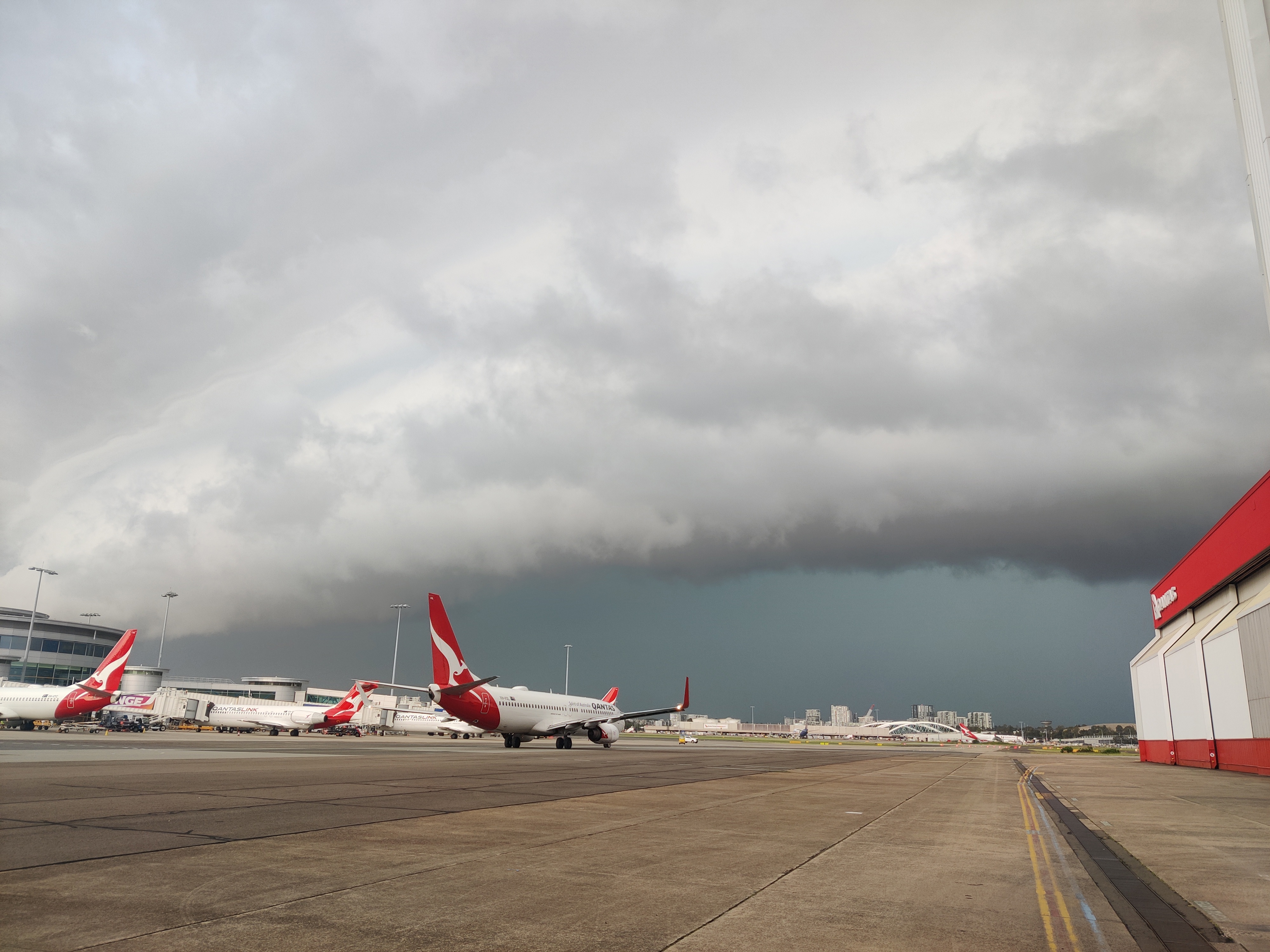

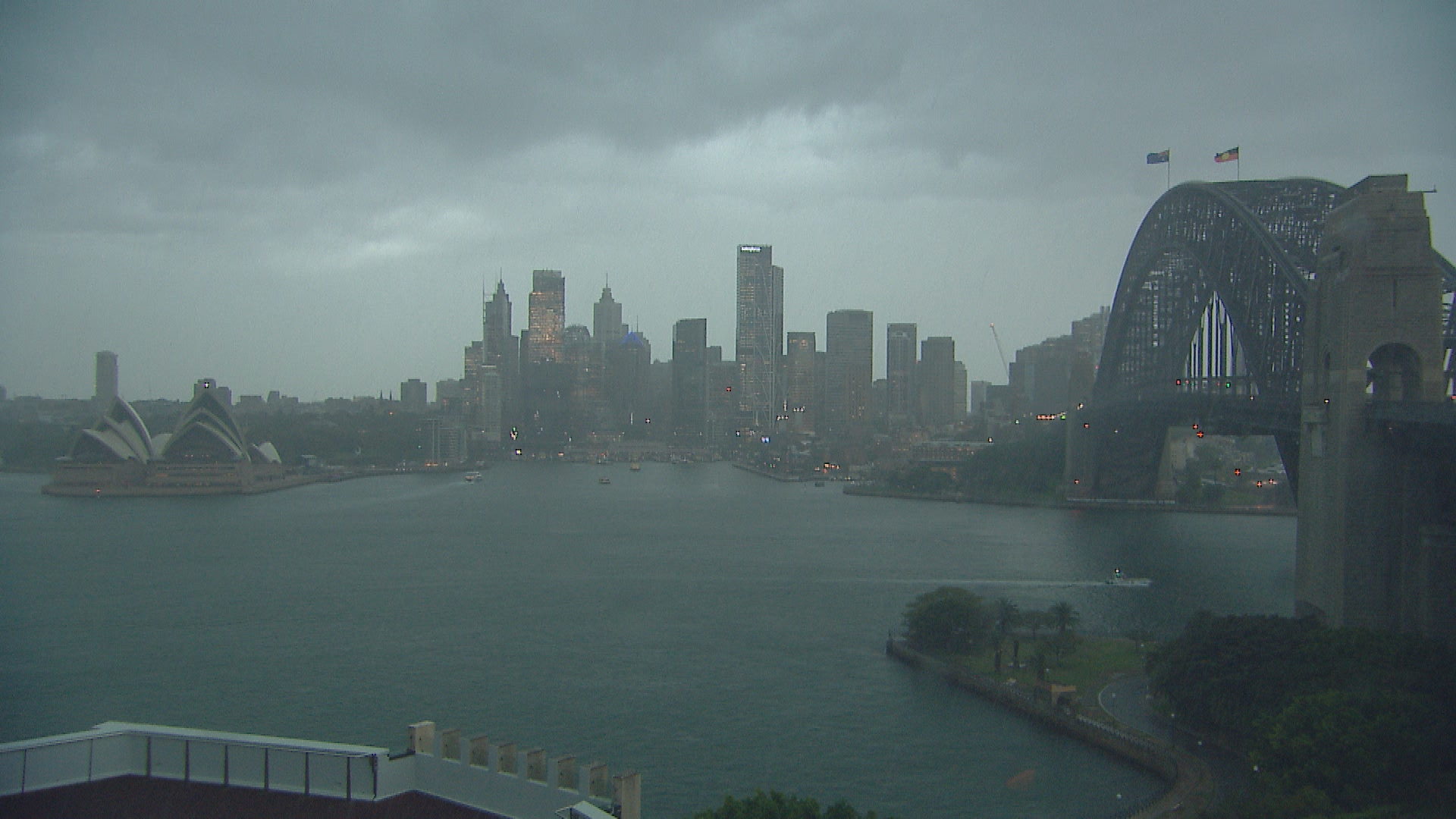
The Sydney basin area has also been told to buckle in for a long night of strong and damaging wind gusts, heavy rainfall and hail.
Wollongong, Sydney City, Sydney Airport, the Sydney Harbour Bridge, waters off Bondi Beach, Newcastle City, Maitland and Belmont was due to be hit hard by 5pm, while Budgewoi, Toukley and Gorokan will start feeling the storm by 5.30pm, according to the Bureau of Meteorology.
The State Emergency Service has dedicated 22 teams to flood and storm assistance operations in preparation for another downpour in the South Coast and Illawarra regions.
"Flash flooding and riverine flooding is likely, and I would encourage the public to follow the advice of emergency service personnel on the ground and to not drive through floodwater," NSW SES Assistant Commissioner Sean Kearns said.
"We know flash flooding can bring debris and sewage over the road, and you just don't know what damage to the road lays beneath the surface.
"Flooding around the Bega River also remains a concern, residents are being asked to prepare, with possible major flooding this evening.
"NSW SES members will be door-knocking residents to warn them of their risks and the potential they may need to evacuate."
Marine wind warnings, hazardous surf warnings and flood warnings have also been issued from the south coast up to the Queensland border.
READ MORE: The Aussie expert who helped mastermind India tunnel rescue
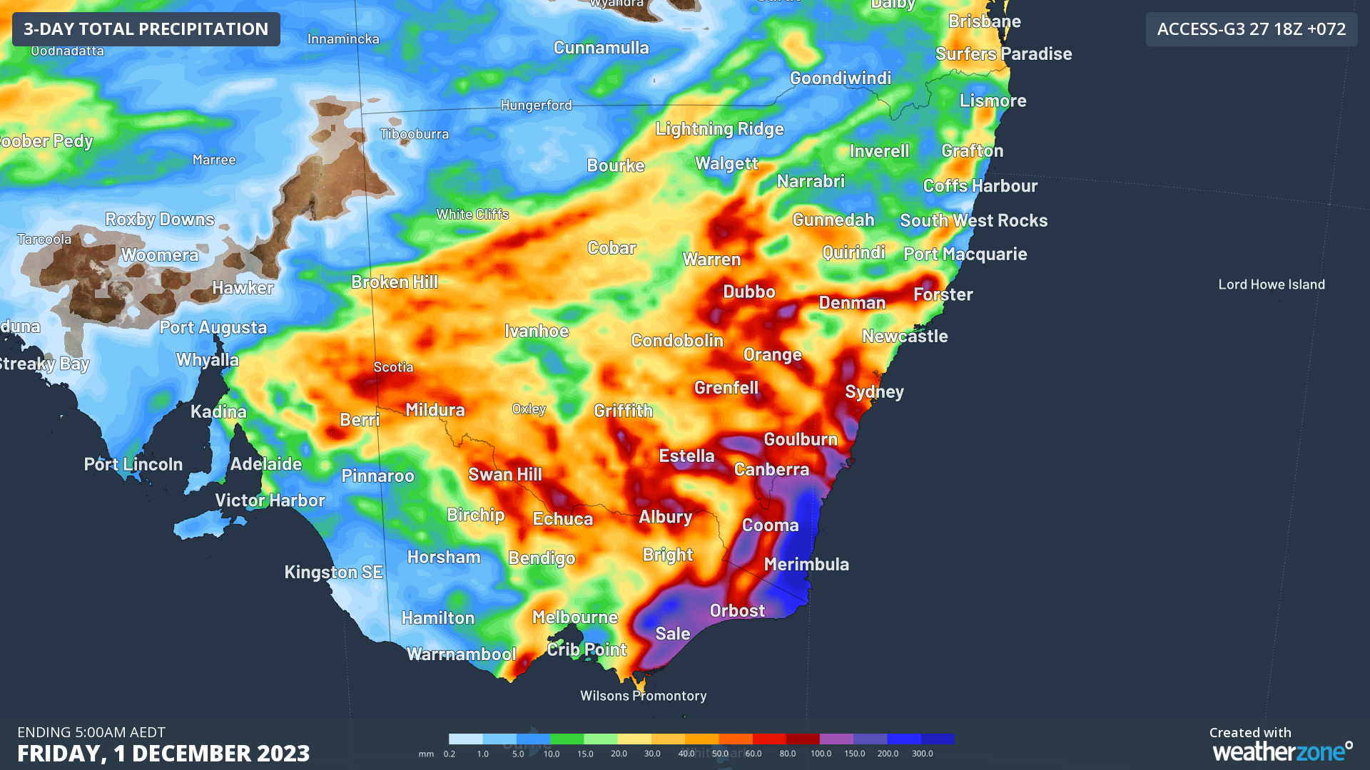
More than 350mm of rainfall soaked the south coast by 9am today, causing flash flooding in St Georges Basin, near Jervis Bay, and South Nowra.
A Bureau of Meteorology spokesperson confirmed earlier that the Illawarra and South Coast regions in NSW had copped the most rain from the weather event so far, with up to 200mm in the past 24 hours in some areas.
From tomorrow, eastern Victoria will be in for a soaking, with falls of up to 100mm expected in the Gippsland region, particularly east of Bairnsdale.
The spokesperson warned of potential flooding that could affect both regions, as well as potential infrastructure and power damage due to strong winds.
Severe storm risks are also affecting Queensland as well as much of eastern and inland Australia.
The spokesperson warned that "super-cell" storms could also be coming in Queensland.
READ MORE: When Jonathan found a lump he went to the doctor – but many men don't
Super-cell thunderstorms last much longer than regular thunderstorms, extending over several hours, which gives them the opportunity to intensify.
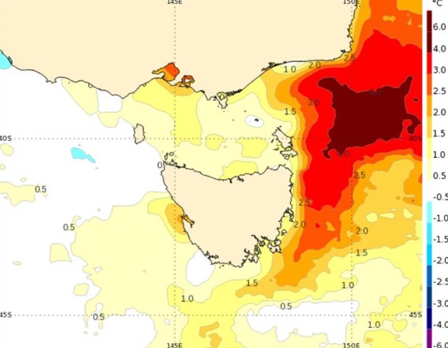
The weather reporting service said "exceptionally warm water" had moved down the NSW coast in the past month.
Satellite data showed sea surface temperatures off the east coast of Tasmania, Victoria, and southern NSW were among the highest 10 per cent of temperatures ever recorded for this time of year.
A pool of water east of the Bass Strait is six degrees warmer than usual for this time of year, Weatherzone said, including up to 1km below the surface.
READ MORE: Feeling the pinch? The RBA boss reckons you're in a 'good position'
Multiple severe weather warnings are in place for NSW and Victoria.
The BOM spokesperson said storms would intensify again in Queensland on Friday.
But by the weekend and through to next week, most of Australia would find itself facing a less furious weather system.
