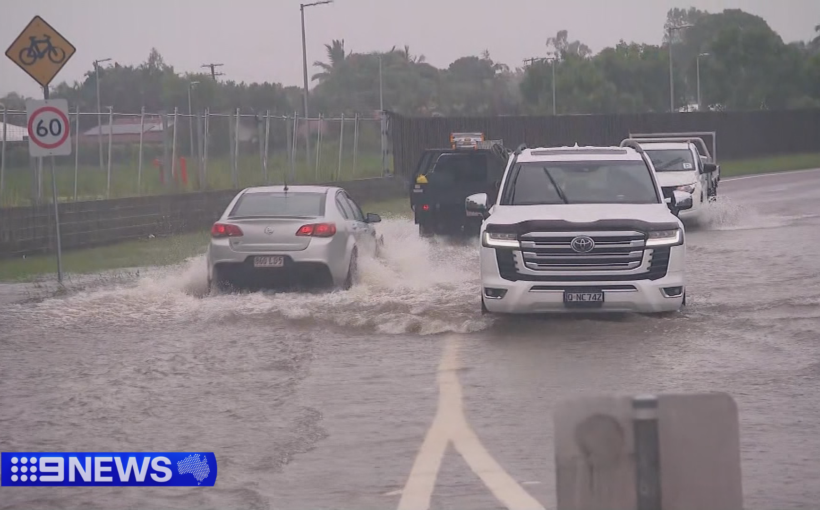

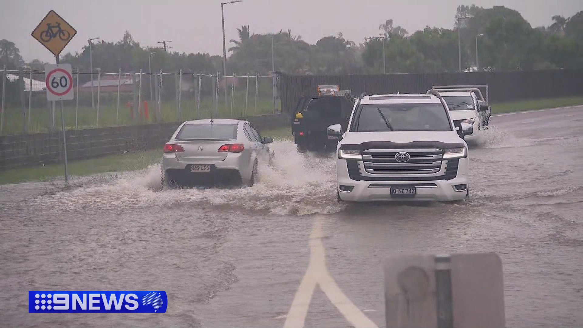
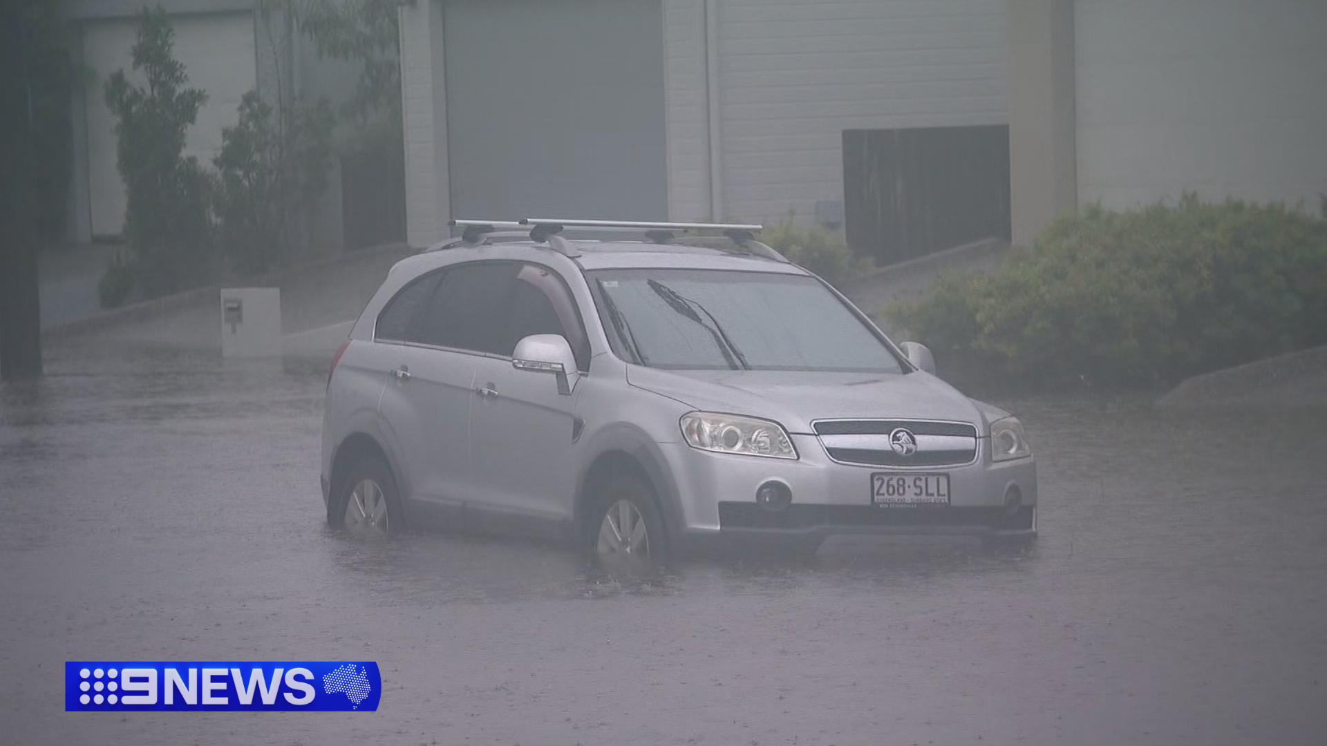
After more than 24 hours of unrelenting rain in Townsville and areas further north, evacuation orders are in place for a number of residents as a flood emergency unfolds.
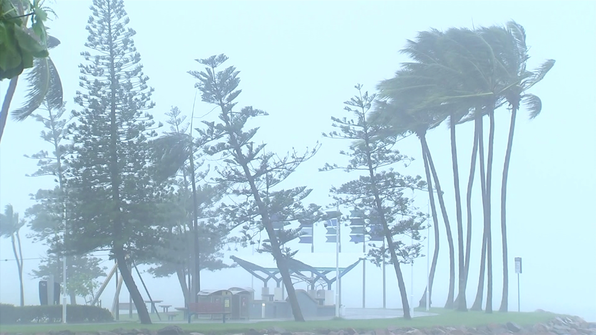
Authorities are bracing for the worst, with the Bureau of Meteorology (BoM) warning conditions are only set to intensify, from Cairns down to Mackay as a slow-moving tropical low hovers over the region.
Almost 400 millimetres of rain fell in just 24 hours in some parts of the state, swamping roads and threatening properties.

Townsville Local Disaster Management Group issued an emergency alert for Cluden, Hermit Park, Idalia, Oonoonba, Railway Estate and Rosslea as dangerous flooding is expected within the next 24 hours.
“Flooding to second-storey floors is possible. Single-storey buildings could be fully flooded,” it warned.
“It may become too dangerous for emergency services to rescue you.”
A severe weather warning remains in place with the BoM forecasting conditions that could lead to “dangerous and life-threatening flash flooding” between Ingham and Giru, including Townsville.
Six-hourly rainfall totals between 120 to 200mm are likely, with isolated falls up to 240mm possible. 24-hourly rainfall totals up to 350mm are also likely, they warned.
A low-pressure system embedded within the monsoon trough is currently located off the coast near Tully and is threatening residents from Cairns to Mackay.
Police officers went door to door in South Johnstone near Innisfail today, urging locals to plan their evacuation if the floodwaters get any higher.
Residents are being urged to get ready to leave and find a safe and high place away from flooding.
Major flood warnings were issued for several rivers around Queensland including:
- The Herbert River
- The Ross and Bohle Rivers, the Black River and Bluewater Creek
- The Haughton River Catchment
Further moderate and minor flood warnings have been issued for several other rivers.
Similar warnings were issued in parts of the Cassowary Coast this morning with South Johnstone residents advised to leave immediately and Mourilyan residents urged to prepare to evacuate.
Evacuation centres are open around the state, with about 25 Townsville residents already moving to an evacuation centre by 6pm (7pm AEDT).
Townsville’s ‘strand’ is usually flat but some locals were seen surfing on it before the council closed all beaches this afternoon.
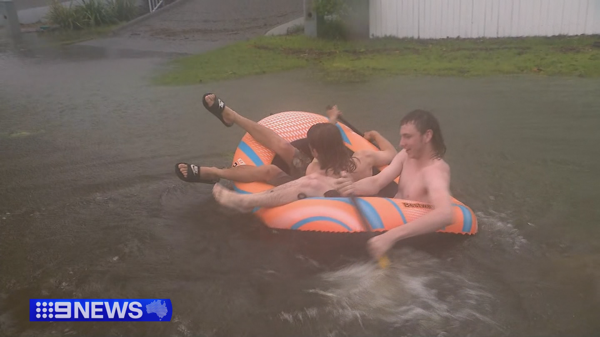
Others were seen fishing or navigating on inflatables in the flooded streets.
The council has since advised residents to stay out of all water for their health and safety.
“Floodwater is incredibly contaminated with bacteria and can very easily cause severe hygiene problems,” Townsville Public Health Unit Director, Dr Steven Donohue, said.
“Do not let kids play in floodwaters. Remember, even a little bit of flooding can be dangerous.”
Six years since major Townsville floods
Some locals said the conditions reminded them of severe flooding in the region in 2019.
“Let’s hope it doesn’t get to what it was in 2019 because we all got flooded out there,” one local told 9News.
Reports that crocodiles were being swept up in the floodwaters and ending up in residential areas left another local concerned.
“I’m a bit too British for this, like crocs in flood water, it’s not really a consideration I’ve ever had to make before,” she said.
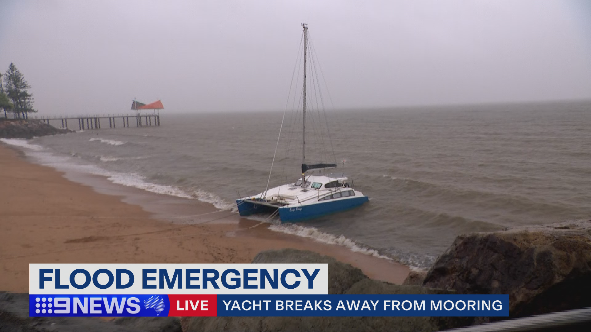
A yacht broke its mooring at the Strand marina, washing up on the shore further down the beach.
Maritime authorities were attempting to secure it in the midst of the wild and windy conditions.
Premier urges residents to listen to emergency advice
Queensland premier David Crisfaulli has urged affected residents to listen to the advice from emergency services.
“This is really important that Queenslanders understand that if somebody turns up at your door from police, fire, SES or our friends at the Australian Defence Force, they are there to give you a message and it is important that people heed that message,” he said at a press conference this afternoon.
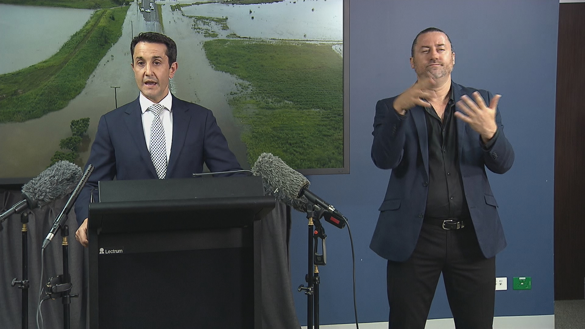
“Make your provisions in the event you do have to go.”
“The most important thing is that we get through this without a loss of life. It’s far more important than any asset, any home, any piece of community infrastructure,” he added.
Crisafulli said he’s working with the federal government and support will be delivered.
‘Significant weather event’
The Bureau of Meteorology’s Matthew Collopy stressed that this was a “significant weather event”.
“We’ve already seen extreme rainfall, and it is that rainfall, that intense, localised and widespread rainfall, that is our major concern,” he said at the press conference alongside the premier today.
“It is possible that we’ll see two to three-day rainfall totals in excess of 1000mm.”
In the 24 hours to 9am today, North Ward saw the worst rainfall of 381mm followed by Deeragun with 328mm and Bushland Beach with 321mm.
Since 9am, Ingham recorded 290mm of rainfall, while Cardwell counted 184mm in the gauges.
North Queensland, particularly between Cairns and Mackay, has been lashed with damaging wet weather for the past week.
“Some of those falls have reached 500mm and even point locations up to 1000mm over the past week,” Collopy said.
There are three troughs currently within the monsoon trough; one off the coast of Ingham, another over the Gulf of Carpentaria and a third out in the Coral Sea.
The trough over the Gulf of Carpentaria has a low probability of forming into a tropical cyclone and the trough in the Coral Sea has a moderate probability of forming into a tropical cyclone.
The conditions are expected to continue into mid-next week, depending on the strength and position of the weather system.
