

Residents across several particularly exposed parts of northern NSW have been urged to prepare to evacuate as Cyclone Alfred creeps slowly towards south-east Queensland.
Forecasters predicted gale-force winds would start to hit coastal areas from Double Island Point, north of the Sunshine Coast, to Grafton, in northern NSW, overnight into Thursday.
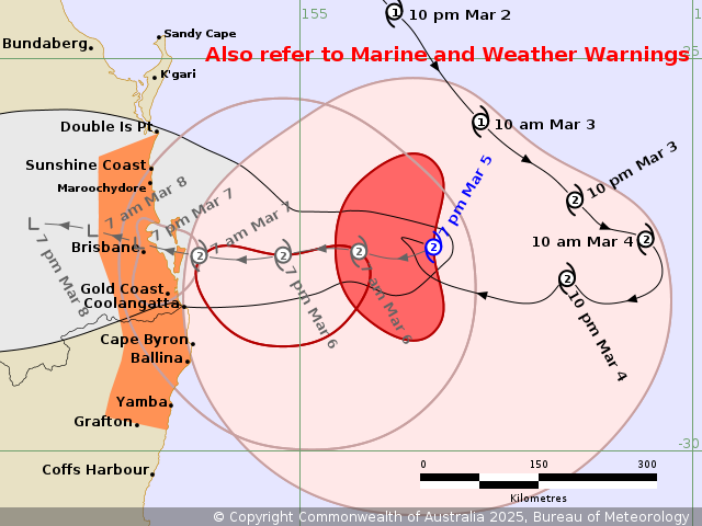
Brisbane was still looking most likely to cop the worst of the category 2 storm's destructive core but the Bureau of Meteorology flagged it might cross the coast later than expected.
READ MORE: Which areas are at most risk of flooding when Alfred makes landfall

At 10pm (11pm AEDT), Alfred was 365 kilometres east of Brisbane and the Bureau of Meteorology had broadened its forecast landfall time from "Friday AM" to "during Friday".
The latest track map showed the system's core crossing South Stradbroke Island at 10am on Friday and inland of Brisbane as a tropical low by 10pm, with significant uncertainty. Earlier predictions had Alfred crossing the mainland coast as early as Thursday night.
There was also less detail about the speed of the cyclone, which was described simply as "slow moving" after being clocked heading north-west at 7km/h earlier in the night.
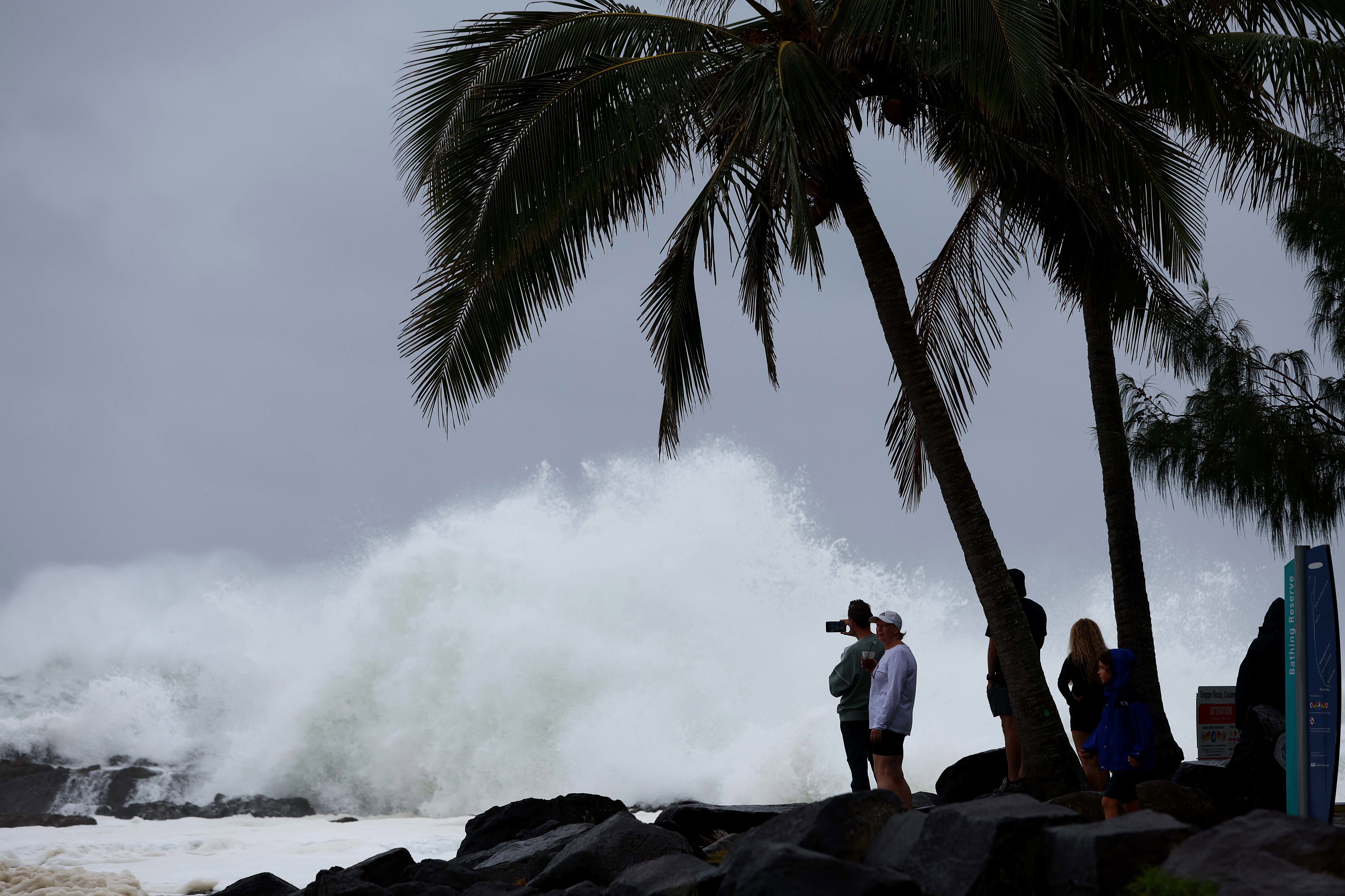
Alfred, the first tropical cyclone to hit so far south in five decades, is expected to generate destructive wind gusts of up to 155km/h near its core and damaging 120km/h gusts across the whole warning area.
But flooding is the bigger concern for most, particularly for areas south of the eye, which can expect 300 to 400 millimetres in a day, combined with dangerous storm tides and abnormally high tides.
Slow-moving cyclones can be more devastating in terms of flooding because they dump rain in one spot for a longer period.
READ MORE: Video shows towering swells cruise ships have encountered
9News weather presenter Garry Youngberry said there was a chance the slowing could have other concerning effects.
"With him slowing down, that is certainly more favourable for him to intensify further and, just before impact, there is a chance it could become a category 3 tropical cyclone," he said.
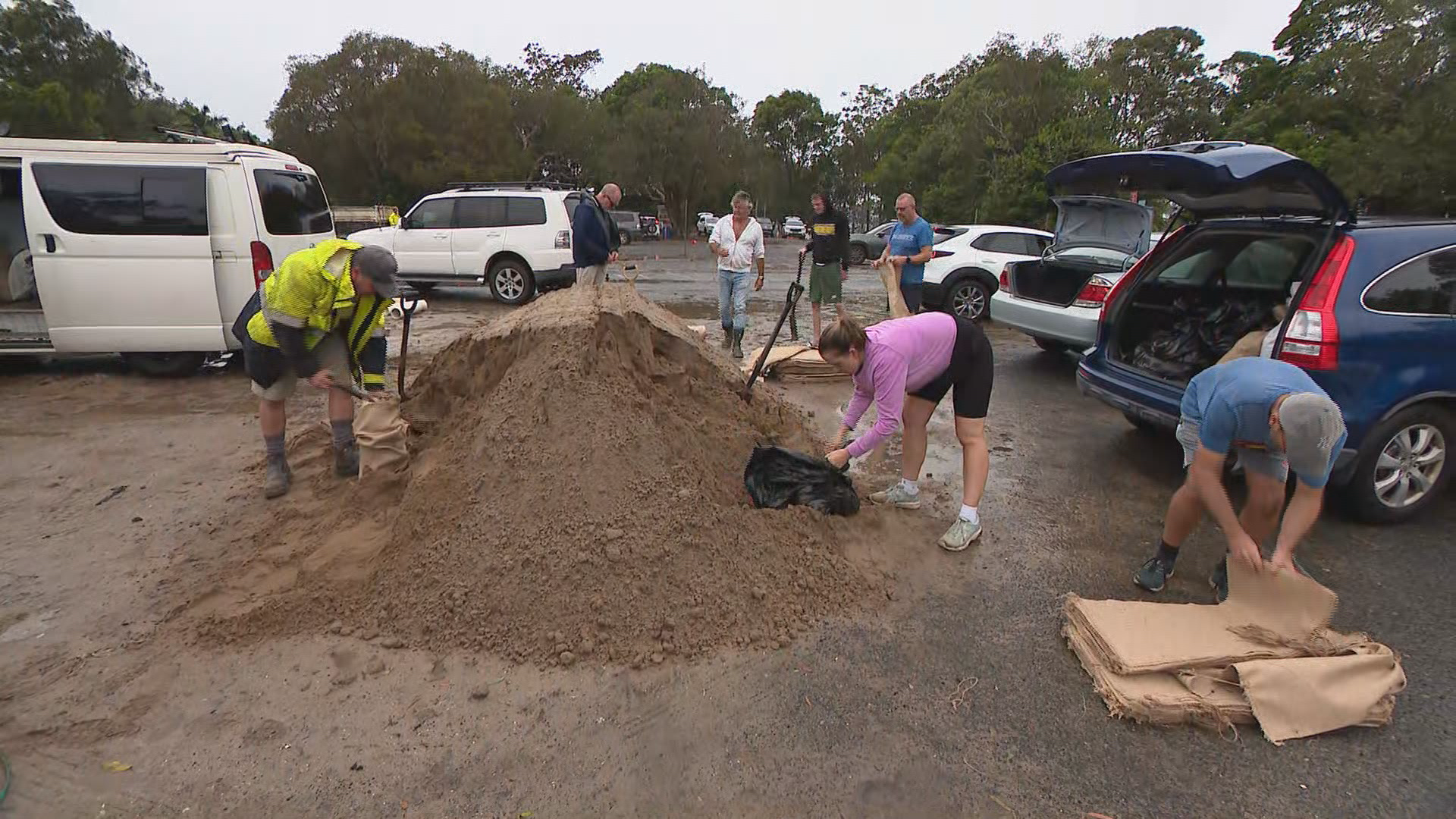
Several caravan parks and other exposed areas across parts of Pottsville, Hastings Point, Fingal Head, The Flat, Kyogle, and Chinderah in Northern NSW were urged to prepare to evacuate on Wednesday night.
The caretaker at Tasman Holiday Parks North Star, who asked for his name not to be used, told 9news.com.au all tourists had evacuated but about 120 residents stayed behind.
"They don't have anywhere to go," he said, adding that they were comfortable about what was to come.
He said all the preparations had been finished, including repairs, putting loose objects away and moving chairs.
"We've done all that already. Done all that yesterday," he said.
"Yeah, prepared everything. Even shut the servo."
READ MORE: NSW schools among latest closures as Cyclone Alfred creeps closer
Major flooding is possible at the Bellinger River at Thora from Friday and at Bellingen from Saturday, with minor floods possible at Repton from Friday.
On Wednesday, almost every coastal local government area in south-east Queensland urged its residents to prepare to take shelter and shared details of evacuation centres.
All south-east Queensland public transport was shut down at midnight on Thursday, along with more than 1000 schools and even the footpaths on the Story Bridge.
Flood alerts are in place for about 6000 properties on the Gold Coast with effects expected to be felt as far as Logan.
Queensland Premier David Crisafulli told 9News this evening that precautions have been made to ensure residents are safe and recovery efforts are "so much easier".
"I've seen the resilience of Queenslanders at both ends of the state and the way that we deal with natural disasters," he said.
"We are the best in the globe at it and I want Queenslanders to know that we have pre-positioned the things that will make the recovery so much easier.
"There won't be any daylight between the response and the recovery."

NSW Premier Chris Minns arrived in Lismore, where he would be getting updates from the emergency operations centre, on Wednesday night.
With 800 millimetres of rain possible in the coming days, the were fears the repeatedly flood-battered town's levee might not hold.
As locals prepared, evacuation centres were set up and hundreds of extra SES personnel mobilised.
DOWNLOAD THE 9NEWS APP: Stay across all the latest in breaking news, sport, politics and the weather via our news app and get notifications sent straight to your smartphone. Available on the Apple App Store and Google Play.
