

Eastern states of Australia will be lashed by thunderstorms and heavy rain on Thursday with already swollen rivers predicted to flood.
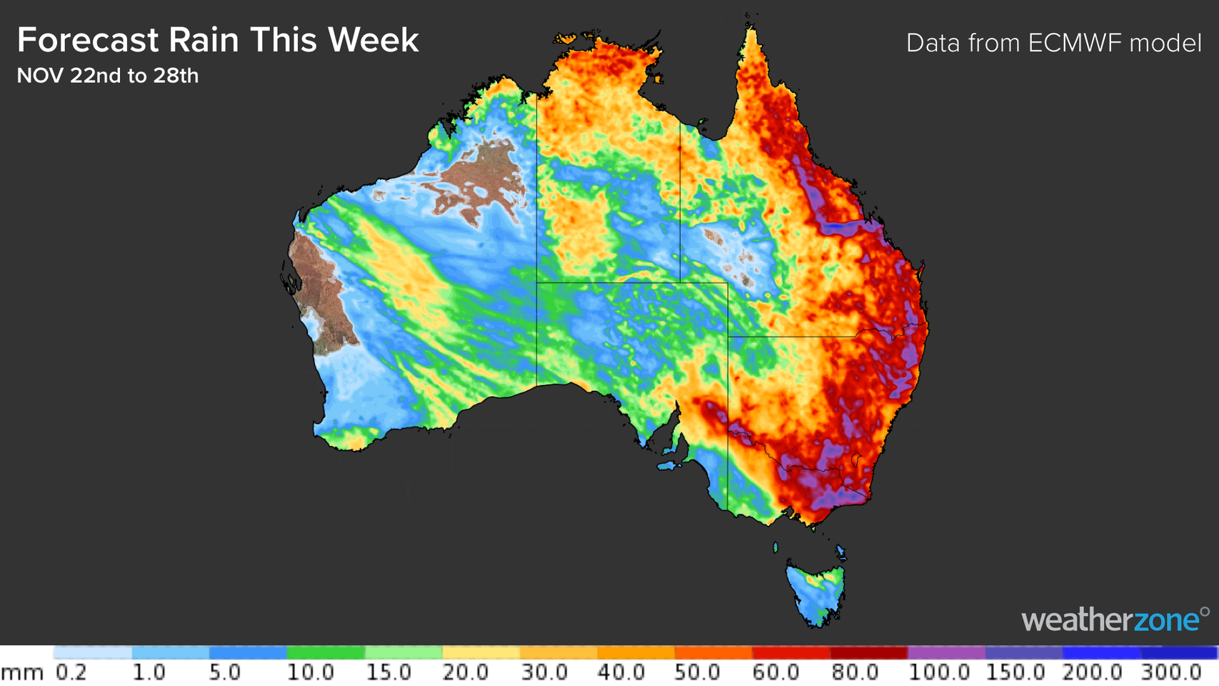
The Bureau of Meteorology (BoM) said there will be heavy rain across northern Victoria, most of NSW and southern inland Queensland over the rest of the week.
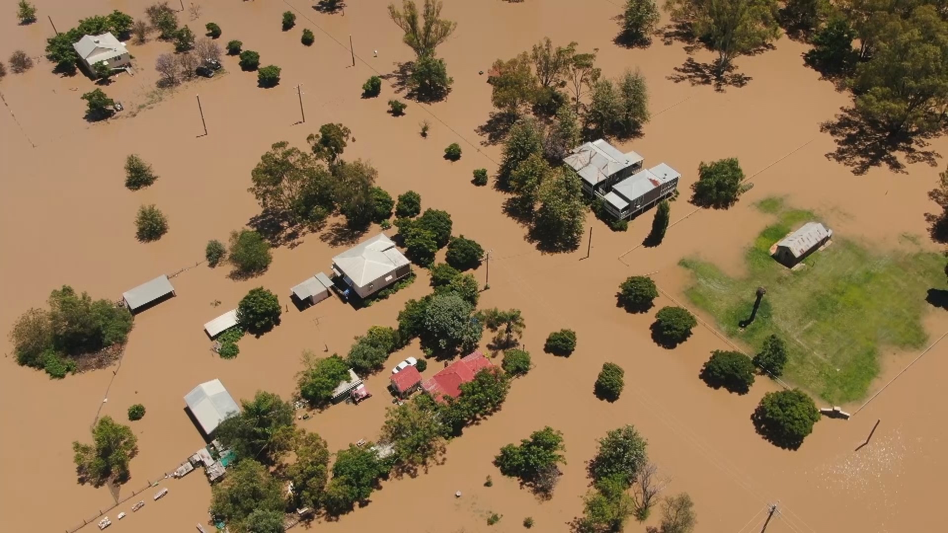
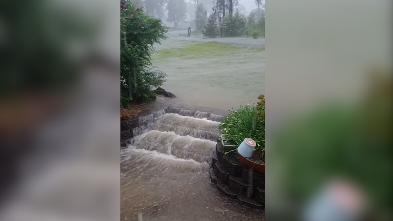
Suburbs in the NSW north-east, including Gunnedah, have flooded today with waters expected to continue rising.
Weatherzone said November has been a particularly wet month for NSW with more than two months’ worth of rain during the last three weeks.
Major flood warnings remain for the NSW Central West with the Lachlan River at Forbes, Cotton Weir and Jemalong continuing to overflow.
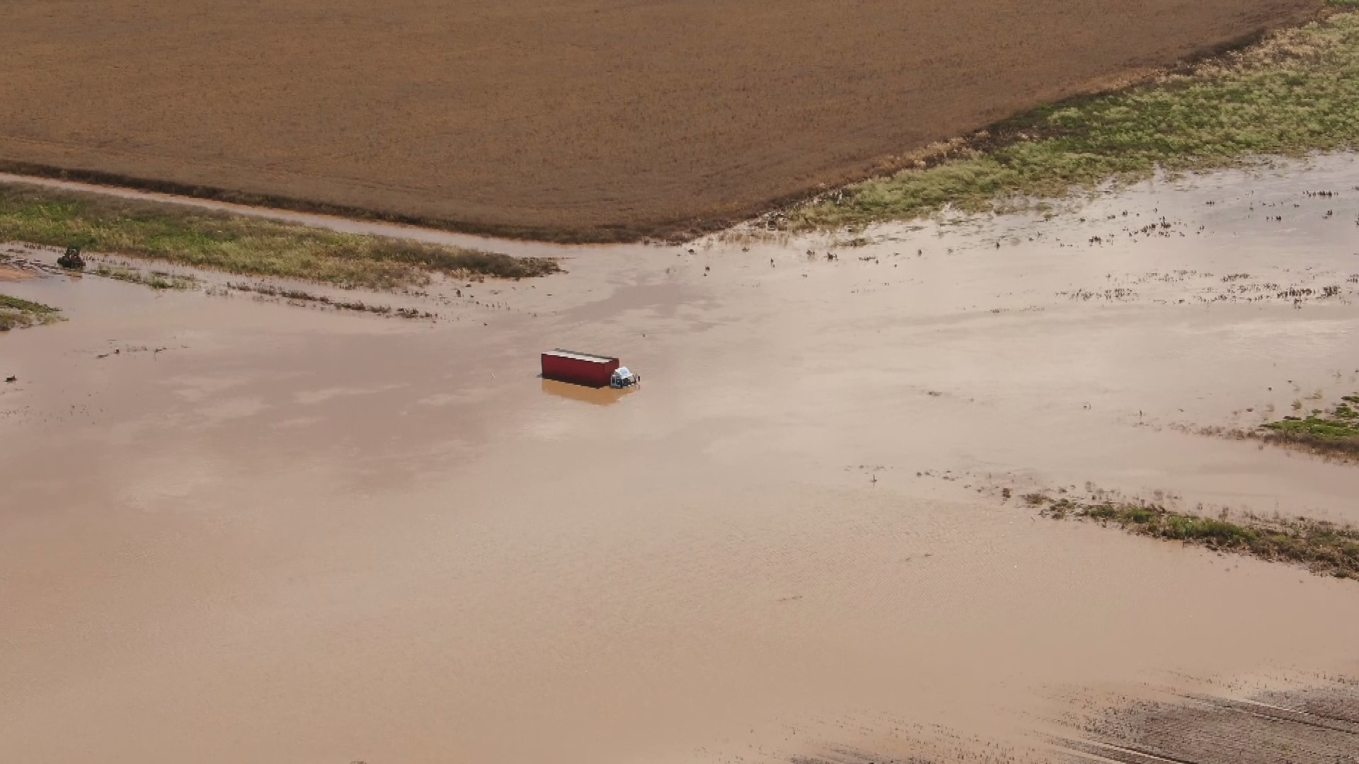
Residents are urged to avoid floodwaters after multiple rescues across the state, including a police officer who saved two boys in central west NSW near Condoblin on the weekend.
Major flood warnings are also in place for Gwydir and Namoi.
There are minor flood warnings for the state’s mid-north coast including the Bellinger River, Macleay River, Macyntire and Severn Rivers, Castlereagh River, Paroo River, and Macquarie River.
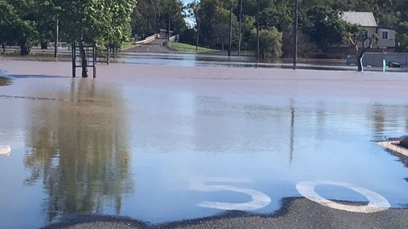
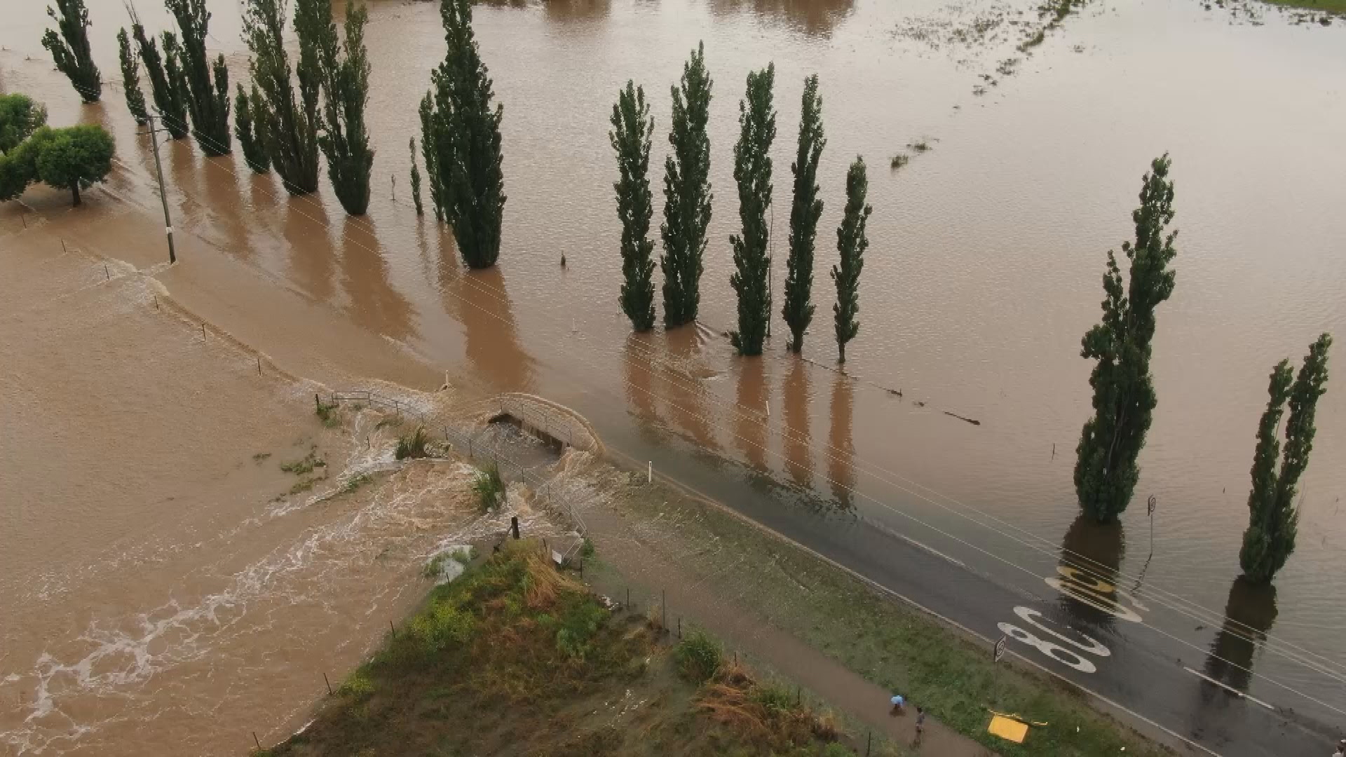
Tamworth and the Hunter region saw major flooding yesterday and it even blocked roads cutting off workers and HSC students.
It comes as an upper-level trough will form into a cut-off low and move east, causing moisture-heavy air to be above the east of the country, according to Weatherzone.
BoM meteorologist Dean Narramore said Thursday is the main concern, when heavy rain will hit the eastern states.
“Over the next four days we’re likely to see widespread 50 to 100 millimetres rainfall over eastern Queensland, eastern and central NSW and possibly parts of northern and eastern parts of Victoria,” he said.
More rainfall in already-saturated areas such as the NSW Central West, north-east NSW, and East Gippsland in Victoria could experience flooding.
“Flooding is likely to increase for coming days particularly on Thursday and Friday.”
Showers and thunderstorms will continue to affect NSW every day for the rest of this week.
“Widespread falls of 40-80mm are likely across multiple districts in NSW by the end of this week, with some places likely to see more than 100mm,” Ben Domensino, from Weatherzone, said.
The wild weather has turned dangerous after a bushwalker in her 30s was killed by a falling branch in Watagans National Park at Cooranbong, near Lake Macquarie on the Central Coast.
The first tropical cyclone of the season has also formed off the south-east of Christmas Island.
Tropical Cyclone Paddy doesn’t present an immediate threat to the mainland or any offshore communities at this stage.
The category one system will continue to move slowly south before moving west and starting to weaken later on today.
Queensland
Eastern parts of Queensland will be hit by thunderstorms and rain in the coming days.
Mr Narramore said widespread heavy rain and thunderstorm activity is expected through the east and southern inland over the rest of the week.
Mr How added that rain will intensify “from tomorrow and then peak on Thursday and Friday” across Brisbane and the Gold Coast.
Victoria
Flood watches for northern and eastern parts of the state have been issued.
The BoM said there are concerns for the East Gippsland as rain is forecast over the rest of the week.
East Gippsland already has saturated soil which could result in flooding, the BoM said.
South Australia
New flood watches have been issued for the state with more rain expected to fall in the coming days, the BoM said.
Source: 9News
