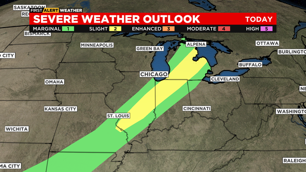
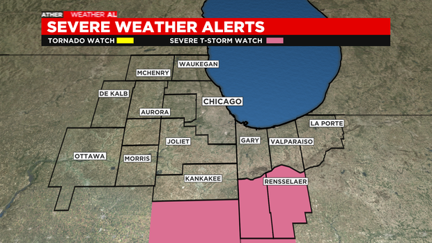
CHICAGO (CBS) — For the risk of severe storms in the late afternoon, mainly south of Chicago and all of NW Indiana into Michigan. The risk level was raised to SLIGHT overnight by the Storm Prediction Center. The risks include damaging wind, hail, and even an isolated tornado.
A Severe Thunderstorm Watch has been issued for Newton and Jasper Counties in Indiana until 7 p.m.
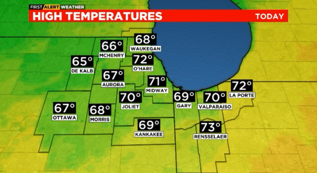
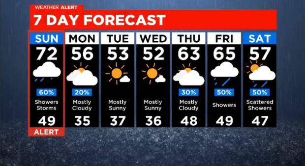
It’ll be a bit cooler, breezy, with some rain and scattered storms today. The high temperature will be cooler but remains well above the norm. Rain ends later in the afternoon to the north. If we’re lucky we may see a glimpse of the sun before the afternoon is done. However, showers and storms into Sunday evening in areas South and South East of Chicago. There’s a small chance (SLIGHT) for severe storms in that area.
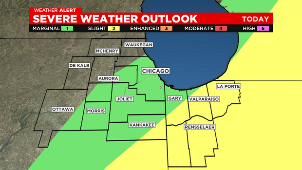
The Storm Prediction Center moved the severe storm threats slightly to the east and lowered the tornado threat to its lowest (2%) level.
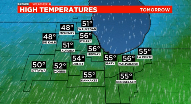
Mostly cloudy and cooler on Monday. In fact, the entire week ahead will feature temperatures below the norm. We’ll see dry conditions, for the most part, with a chance of frost Tuesday night into Wednesday morning.
STATS
Normal High: 62
Saturday’s High: 84
Today: 72
Sunrise: 5:57 a.m.
FORECAST
Today: Showers and some storms into the midday hours to the north. Severe storms are possible SE of Chicago this afternoon. Breezy with a high of 72.
Tonight: Mostly cloudy. 65.
Monday: A stray shower. Mostly cloudy but much cooler, 56.
Source: ChicagoCBS