
More Certain
– Strong winds Wednesday-Thursday
– Big temperature swing Wednesday-Thursday
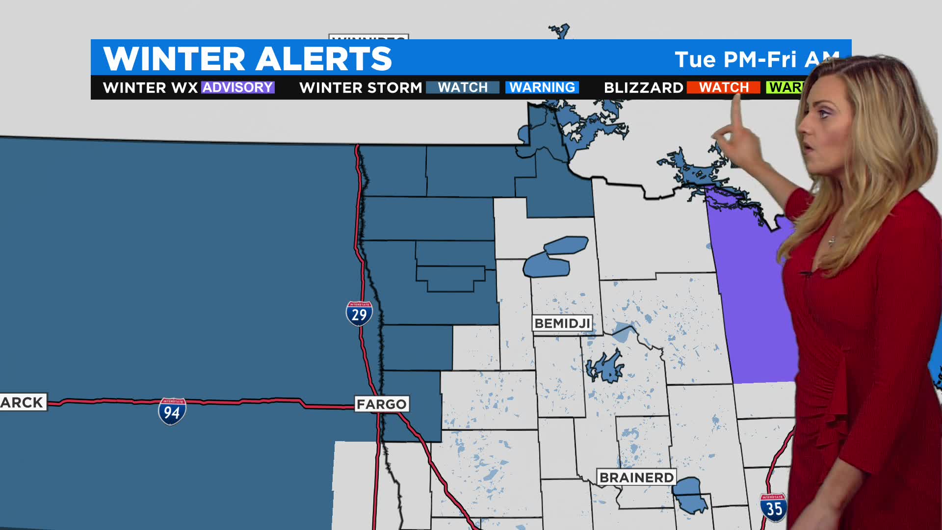
– Winter storm conditions in northwestern Minnesota
Less Certain
– Severe weather Tuesday or Wednesday
– When we see rain change to snow
– Where snow accumulation will occur, and the amount
MINNEAPOLIS (WCCO) — Another messy weather system is moving towards Minnesota, which will bring a mix of rain and snow again mid-week.
The WCCO Weather Team says while the Twin Cities almost reached 60 degrees Sunday, it was significantly colder up north, where they dealt with rain showers that will likely turn into snow during the overnight hours into Monday. Less than an inch should accumulate in most places, though communities like Grand Rapids, Ely and Grand Marais could see a little bit more.
Monday will be another mild, breezy and partly cloudy day, with a high of 59 forecasted for the metro.

(credit: CBS)
The weather will take a turn on Tuesday, as a major storm will be moving through. Expect widespread precipitation from Tuesday to Thursday, with strong winds arriving on Wednesday. There is also a chance of severe weather Tuesday in southern Minnesota, with hail being the biggest threat.
Winds will howl from Thursday through Friday, with speeds in excess of 55 mph expected. Temperatures will also plummet into the 20s and 30s, and snow showers will fall on Thursday. Northwestern Minnesota may see up to 8 inches of snow. After the storm moves out, temps will fall well below average.
Easter weekend is looking to be quiet and less cold.
Source: CBS

