
The weather bureau is warning of widespread flooding across parts of south-east Australia as a destructive, powerful cold front looms.
Residents from inland and central NSW, as well as the ACT, are being warned of heavy rainfall, hail and damaging wind gusts in excess of 90km/h.
A severe weather warning is in place for parts of the south-east and central regions of NSW and heavy rainfall lashes the western slopes and parts of the ACT this afternoon.
⚠️UPDATE: #SevereWeatherWarning updated to include larger area of the #CentralTablelands, with heavy rainfall and damaging winds still possible about southern and central inland. Take care on roads, flash flooding possible today.
Keep monitoring warnings: https://t.co/PrL0Bec7Mv pic.twitter.com/Ycq3mxyFNK— Bureau of Meteorology, New South Wales (@BOM_NSW) August 4, 2022
The powerful winds will push through to the Illawarra region into Friday.
Central and south west catchments across NSW have been issued with flood warnings, with the potential for widespread minor and major floods.
Catchments of concern include the Upper Murray, Lachlan and Mitta Mitta rivers.
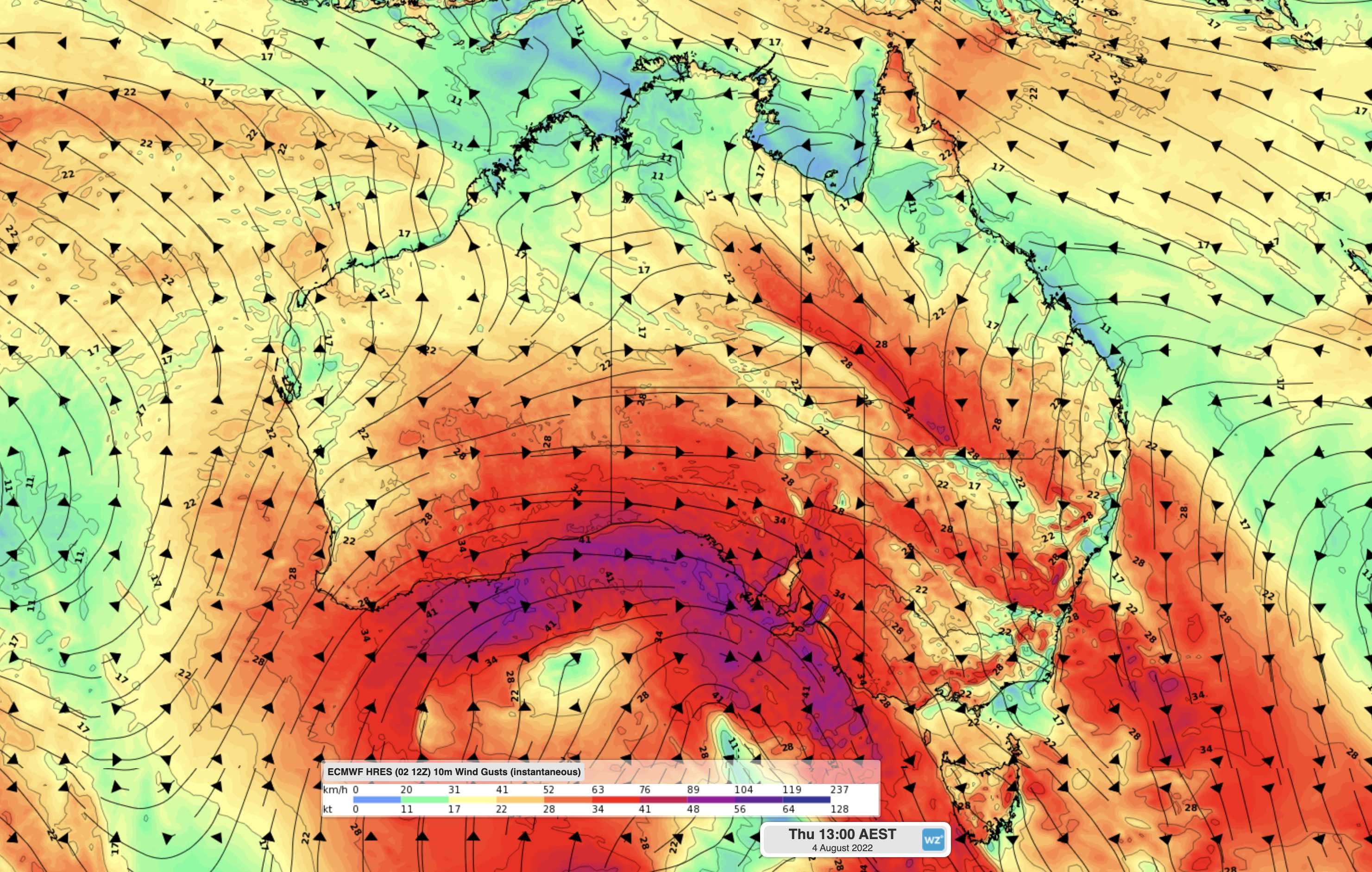
“Rainfall totals of 10 to 30 mm are likely over a broad area of south-eastern Australia on Thursday,” Weatherzone said.
“The heaviest rain will be in central and southern inland NSW and the ACT, where 24-hour totals could exceed 150mm on and west of the ranges, with six-hourly rainfall rates possibly reaching 50 to 60mm.”
The the extreme weather has already moved from the west, with toppled trees and collapsed ceilings in WA, and some parts of Victoria battered with winds of more than 110km/h.
A large area of South Australia, and some elevated areas in Victoria and north-western parts of Tasmania are on high alert with warnings of heavy rain and damaging winds.
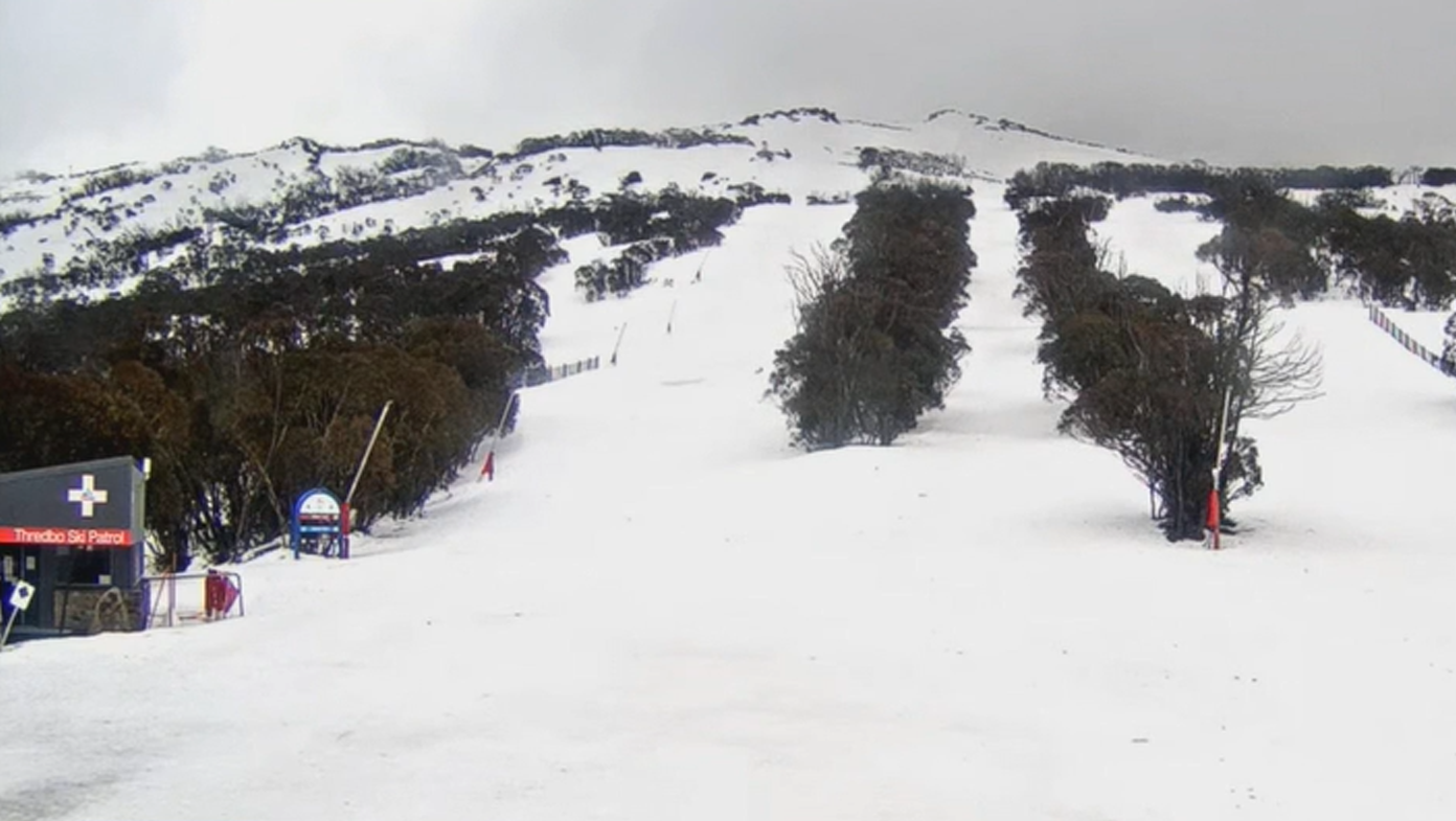
Thredbo ski resort in NSW has been forced to close lifts due to safety reasons, as the wild weather lashes the alpine region.
In South Australia, damaging winds up to 90 km/h will be felt across Adelaide and the Hills.
“We are in for a very wet afternoon, particularly in our northern region, around 50-60mm expected up in the Hills,” 9News presenter Jesse Burns said.
“A wet weather warning has also been issued, with a month’s worth of rain expected this week alone, particularly in our northern region with around 50mm to 60mm expected around The Hills.
“That’s cause for alarm with potentially localised flash flooding in those areas.”
Senior meteorologist at the Bureau of Meteorology (BoM) Dean Narramore explained the next cold front is “tapping into tropical moisture”, which will cause moderate to heavy rainfall across parts of Victoria and NSW.
“That could lead to another possible flood event for inland parts of NSW,” Narramore said.
“Looking at the rainfall totals we will see light to moderate falls right across WA and SA, but the focus of the heaviest rainfall will be north-east Victoria and south-eastern NSW.”
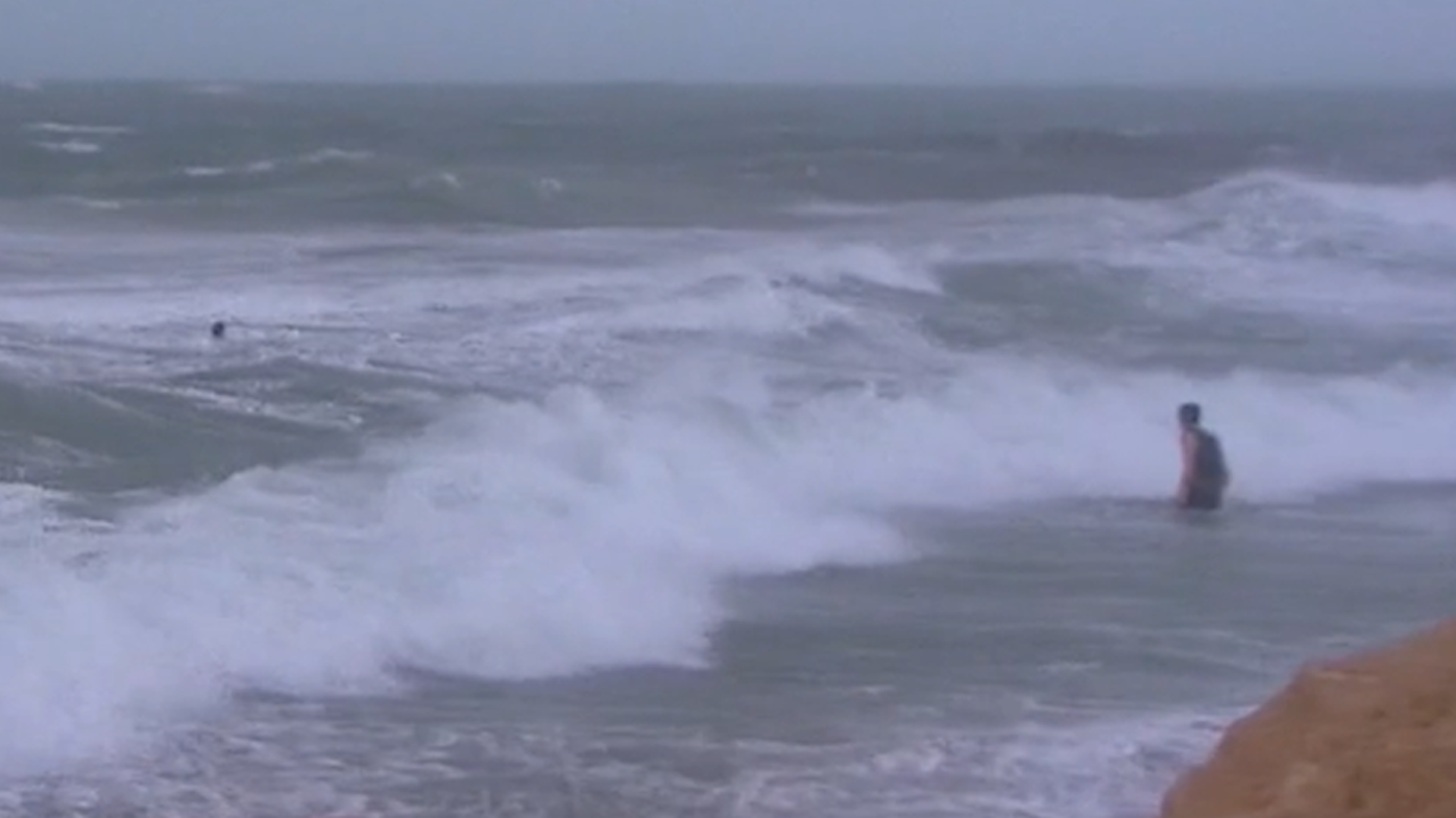
Residents in WA’s central west to south-east corner are being told to stay away from the surf as large swell pounds the coast.
Significant wave heights exceeding seven metres have occurred in exposed locations, and erosion has been observed along the coast.
Source: 9News
