
Queenslanders will face a day of weather extremes as half the state battles ongoing bushfires, exacerbated by a heatwave, while the other deals with the threat of flash floods in the aftermath of Cyclone Gabrielle.
Across the state there are more than a dozen severe weather warnings currently active, including for residents in the Far North all the way to the south-east and along the New South Wales border.
Today will see another day of high temperatures in Queensland, with the vast majority of regions set for sweltering conditions well above 30C.
READ MORE: Survivors still being found as Turkey, Syria quake death toll tops 33,000
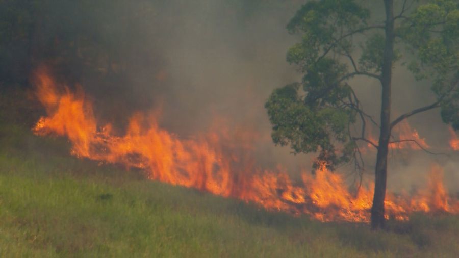
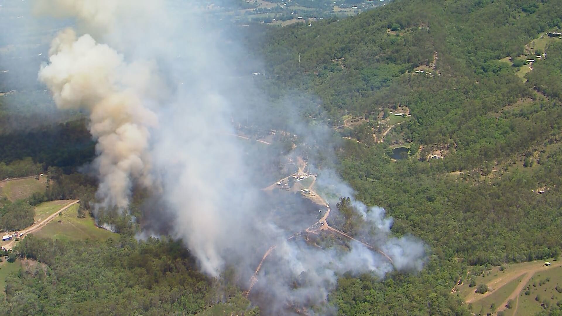
Residents have been evacuated at Montrose near Tara in the Western Downs with an emergency warning issued for a blaze that had threatened homes.
"Maximum temperatures in the high thirties to low forties and minimum temperatures in the low twenties for parts of eastern Queenslander over the next few days," the Bureau of Meteorology said.
Locations set to be particularly affected by the heat include areas aroond the Central Coast and Whitsundays, Capricornia, Central Highlands and Coalfields and Wide Bay as well as the Burnett Districts, Bundaberg, Gladstone, Gympie, Gayndah, Rockhampton, Rolleston, Taroom, Woorabinda, Yeppoon.
Others living at Wolvi near Gympie have also been told to prepare to leave due to a grassfire burning in the community.
Emergency services received dozens of call-outs across the state over the weekend as low humidity and south-westerly winds proved to be a dangerous combination for crews on the ground.
Cyclone Gabrielle's lingering threat
More than 10 flood warnings remain in place throughout Queensland, as Gabrielle's impact is still felt despite now having moved toward New Zealand.
Wet weather will impact a number of regions today stretching from Cape York in the north, all the way down to the Gold Coast in the south-east.
The biggest threat for flash flooding will be occur around the Cooper Creek, Georgina River and Thomson River, while the Barcoo, Gilbert, Norman and Flinders Rivers will also be in the firing line.
https://twitter.com/BOM_Qld/status/1624640281457958912?s=20&t=Doj0Lbn0k7JZj7JVXQwpJw
You can see a full list of Queensland's warnings here.
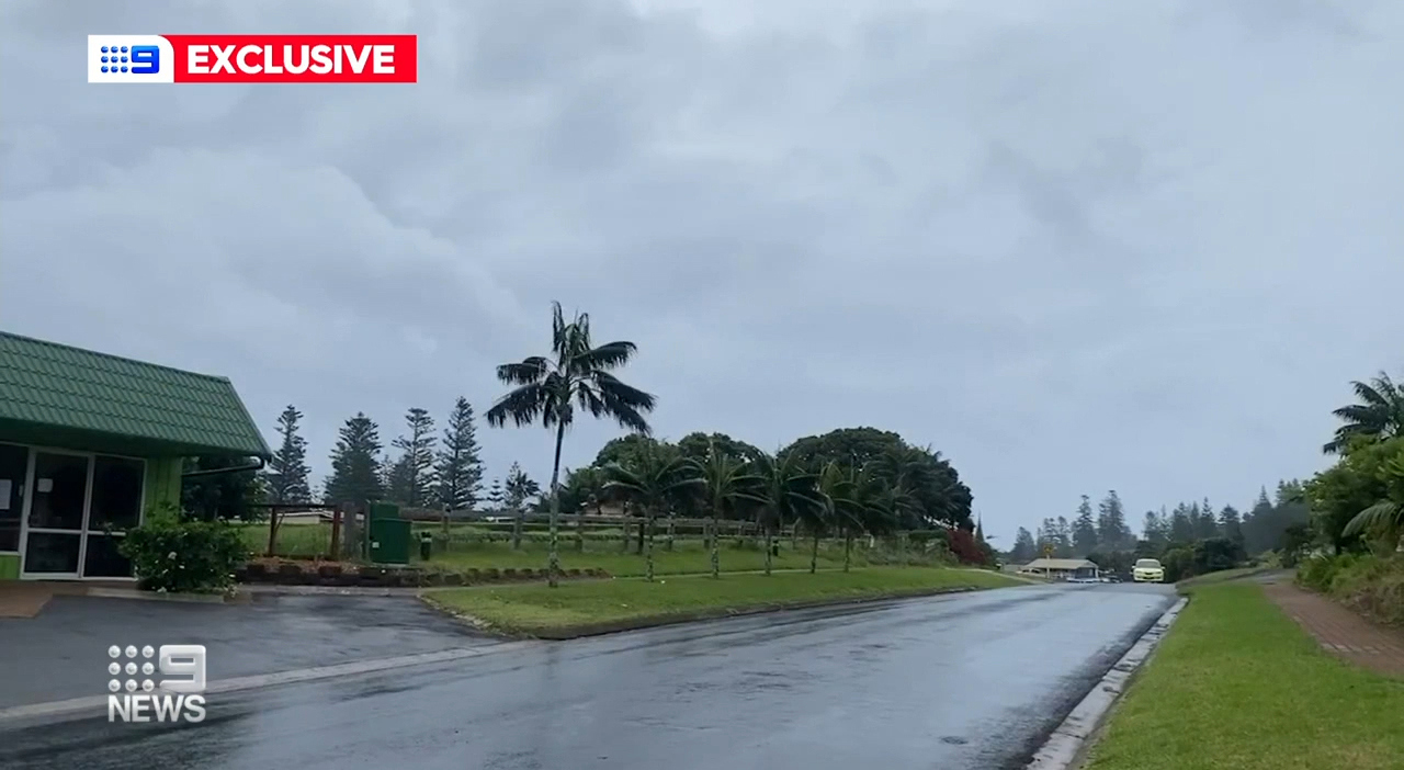
All severe weather warnings for Norfolk Island, which was earlier under major threat from Gabrielle, have now been cancelled.
However damaging surf is expected to continue.
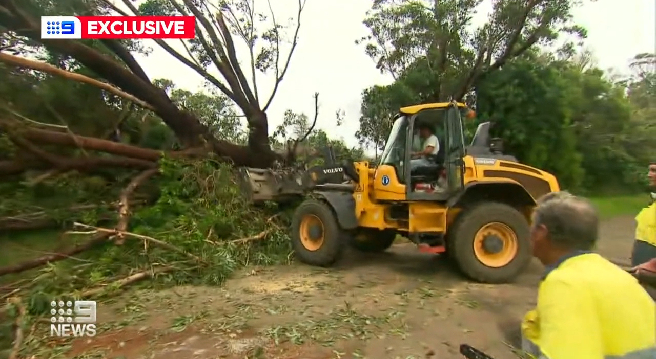
Cyclone Gabrielle, now a tropical low, left some destruction on Norfolk Island with residents reporting that trees and power lines down.
But the threat of the cyclone is now moving towards northern New Zealand bringing winds of up to 100km/h and heavy rain.
Elsewhere in Australia
Though Queenslanders will be put through the wringer today, the majority of the country will see relatively settled conditions on Monday.
In NSW, it'll be a mostly cloudy day across the state with temperatures in the Sydney metro area set to reach tops in the mid twenties, a dramatic change from sizzling conditions over the weekend.
A hazardous surf warning is in place along the Byron Coast, Coffs Coast, Macquarie Coast, Hunter Coast, Sydney Coast, Illawarra Coast and Batemans Coast.
In the Northern Territory, a severe weather warning is in place for Arnhem and Carpentaria districts, while a cyclone watch warning has been issued for a number of regions.
https://twitter.com/BOM_NT/status/1624654818622025728?s=20&t=Doj0Lbn0k7JZj7JVXQwpJw
"Gales with gusts to 90 kilometres per hour may develop from Cape Shield to Port McArthur, including Alyangula from Monday evening. Gales could extending to the NT Queenslander border," the bureau said.
"Heavy rainfall which may lead to flash flooding may develop about Groote Eylandt during Monday. Six-hourly totals of 140-180mm are possible.
"Severe thunderstorms are also possible during Monday in the Watch area, with heavy rainfall and damaging wind gusts possible."
In Victoria, it'll be a cloudy but fine day, with Melbourne headed for tops of 19C, while in Adelaide, it'll be mostly sunny and 24C.
In Western Australia, a heatwave warning is also in place, with temperatures set to soar up to 35C in Perth today.
Auckland to cop battering, again
Schools across Auckland, New Zealand, will close on Monday as the island nation's largest city braces for the arrival of Cyclone Gabrielle.
More than 36 schools and universities will shut their doors despite no formal order from the Ministry of Education, RNZ said, while the InterCity bus network will also reduce its services.
According to the New Zealand MetService, gale force winds have already been recorded over the North Island on Sunday, with some reaching as high as 140 kph.
"I can't remember a time when the whole of the North Island was on a wind warning," said Lisa Murray, head of Weather Communications for the MetService.
"This is a huge sprawling weather system affecting the country. Extreme rain and wind are expected for many North Island regions, accompanied by phenomenal seas along northern and eastern shores, and significant storm surge near, and slightly in advance of, the cyclone's center."
Meanwhile, with Gabrielle closing in, Air New Zealand said it was canceling multiple long-haul international fights on Monday, as well as Tasman and Pacific Island flights, and domestic services in and out of Auckland, Reuters reported.
In a news conference with local media Sunday, New Zealand's Prime Minister Chris Hipkins once again called on residents across Auckland to minimise nonessential travel, urging those who could work from home to do so.
"We do expect severe weather is on the way so please make sure you're prepared, make sure you have your preparations in place, if you have to stay put for a period of time or if you have to evacuate," Hipkins told reporters.
Sign up here to receive our daily newsletters and breaking news alerts, sent straight to your inbox.
Source: 9News

